Home > Fine Art Storehouse > Map
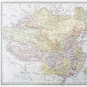
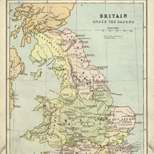
United States of America, Mexico and Central America, published in 1878

![]()
Wall Art and Photo Gifts from Fine Art Storehouse
United States of America, Mexico and Central America, published in 1878
United States of America, Mexico and Central America. Lithograph, published in 1878
Unleash your creativity and transform your space into a visual masterpiece!
Media ID 13666815
© ZU_09
California Central America Contour Drawing Country Geographic Area Gulf Of Mexico Land Latin America Mexico North America The Americas Topographic Map Topography Central District Hong Kong
FEATURES IN THESE COLLECTIONS
> Fine Art Storehouse
> Map
> Historical Maps
> Fine Art Storehouse
> Map
> USA Maps
EDITORS COMMENTS
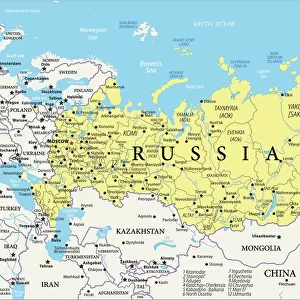
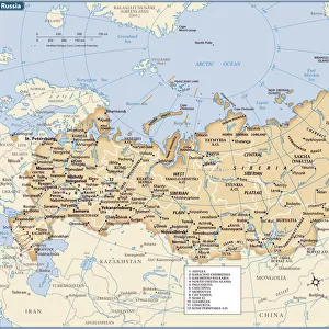
This lithograph, published in 1878, takes us on a journey through the rich and diverse landscapes of the United States of America, Mexico, and Central America. The intricate details etched onto this antique engraved image provide a glimpse into the topography and history of these ancient lands. The horizontal composition showcases the vast expanse of land stretching from California to Central America, encompassing North America's western coast. As we explore this map-like artwork, our eyes are drawn to the majestic Gulf of Mexico that separates these nations. With its contour drawing style and precise cartography, this topographic map offers an invaluable historical perspective. It serves as a window into the past when photography was still in its infancy but had already begun documenting our world. As we admire this print today in 2015 (the year it was photographed), we are reminded of how far we have come since its creation over a century ago. This piece captures not only geographical boundaries but also cultural connections between countries within Latin America. Displayed without any human presence or interference, this lithograph invites us to appreciate nature's beauty and ponder upon our place within it. Its timeless appeal makes it an ideal addition to any art collection or educational setting where one can delve into the fascinating history and geography of these regions known as "The Americas. "
MADE IN THE USA
Safe Shipping with 30 Day Money Back Guarantee
FREE PERSONALISATION*
We are proud to offer a range of customisation features including Personalised Captions, Color Filters and Picture Zoom Tools
SECURE PAYMENTS
We happily accept a wide range of payment options so you can pay for the things you need in the way that is most convenient for you
* Options may vary by product and licensing agreement. Zoomed Pictures can be adjusted in the Cart.