Home > Europe > United Kingdom > Wales > Flintshire > Flint
St Albans AL3 7 Map

![]()
Wall Art and Photo Gifts from Map Marketing
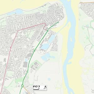
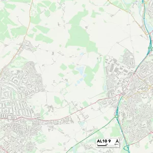
St Albans AL3 7 Map
Postcode Sector Map of St Albans AL3 7
Media ID 19965152
Aysgarth Road Bassett Close Beechfield Close Blackhorse Lane Church End Crown Court Crown Street Cumberland Drive Dunstable Road Fish Street Harding Close High Street Hilltop Lamb Lane Linden Road Meadow View Miller Close Monks Close Pipers Close St Albans St Albans Road St Marys Close The Common The Meadow The Park The Square Woodland Place
FEATURES IN THESE COLLECTIONS
> Animals
> Fishes
> Related Images
> Arts
> Artists
> H
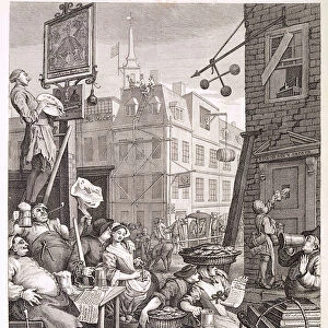
> Harding Harding
> Arts
> Portraits
> Pop art gallery
> Street art portraits
> Europe
> United Kingdom
> England
> Cumberland
> Europe
> United Kingdom
> Wales
> Flintshire
> Flint
> Map Marketing
> Postcode Sector Maps
> AL - St Albans
> Maps and Charts
> Related Images
MADE IN THE USA
Safe Shipping with 30 Day Money Back Guarantee
FREE PERSONALISATION*
We are proud to offer a range of customisation features including Personalised Captions, Color Filters and Picture Zoom Tools
SECURE PAYMENTS
We happily accept a wide range of payment options so you can pay for the things you need in the way that is most convenient for you
* Options may vary by product and licensing agreement. Zoomed Pictures can be adjusted in the Cart.