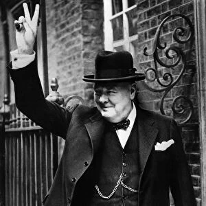
Home > Europe > United Kingdom > England > London > Politics > Winston Churchill
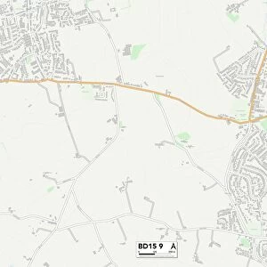
Bradford BD20 7 Map

![]()
Wall Art and Photo Gifts from Map Marketing
Bradford BD20 7 Map
Postcode Sector Map of Bradford BD20 7
Media ID 19966010
Acer Close Aire Street Albert Road Albert Street Ash Grove Ash Street Bent Lane Bradford Bridge Road Cedar Grove Churchill Way Crag Lane Dixon Street East Avenue Elm Road Elmfield Road Garden Place Gordon Street Greenfield Court Greenfield Gardens Hall Avenue Hall Close Hall Drive Hall Street Hardings Lane Hargreaves Street Hazel Grove High Street Holme Close Holme Lane Jackson Street Keighley Road Knott Lane Main Street Manor Way Mill Street Mulberry Way Newby Drive Newlands Drive North Avenue North Road North Street Park Avenue Park Drive Park Lane Parker Street Prospect Street Scott Close Skipton Road Spencer Close Spencer Street Station Road Sutton Lane Sycamore Grove The Acres The Crofts The Poplars Victoria Street Well Street West Croft West Lane Westland Close Willow Way Wilson Street Winston Avenue Wright Street Hall Way
FEATURES IN THESE COLLECTIONS
> Africa
> Zimbabwe
> Rhodesia
> Arts
> Artists
> C
> Jack Corn
> Arts
> Artists
> H
> Harding Harding
> Arts
> Artists
> P
> Gordon Parks
> Arts
> Artists
> W
> Wilson Wilson
> Europe
> United Kingdom
> England
> London
> Politics
> Winston Churchill
> Europe
> United Kingdom
> England
> London
> Sights
> Victoria Park
> Map Marketing
> Postcode Sector Maps
> BD - Bradford
> Maps and Charts
> Related Images
> People
> Politicians
> Winston Churchill
MADE IN THE USA
Safe Shipping with 30 Day Money Back Guarantee
FREE PERSONALISATION*
We are proud to offer a range of customisation features including Personalised Captions, Color Filters and Picture Zoom Tools
SECURE PAYMENTS
We happily accept a wide range of payment options so you can pay for the things you need in the way that is most convenient for you
* Options may vary by product and licensing agreement. Zoomed Pictures can be adjusted in the Cart.