Home > Animals > Mammals > Muridae > Fortior
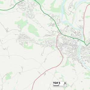
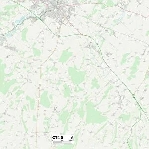
Canterbury CT2 7 Map

![]()
Wall Art and Photo Gifts from Map Marketing
Canterbury CT2 7 Map
Postcode Sector Map of Canterbury CT2 7
Media ID 19968117
Abbey Gardens Beaconsfield Road Beverley Road Canterbury Crossways Darwin Road Downs Road Farleigh Road Halstead Close Hanover Place Library Road Lyndhurst Close Malthouse Road Mandeville Road Market Way Monks Close Moorfield Orchard Close Pine Tree Avenue Redwood Close Ringwood Close Salisbury Road Sandhurst Close Shaftesbury Road St Michaels Place St Michaels Road St Stephens Close St Stephens Court St Stephens Road Stephenson Road The Close The Crescent The Terrace Tunstall Road Tyler Close University Road Uplands Westerham Close Whitstable Road Woodland Way St Stephens St Stephens Green
FEATURES IN THESE COLLECTIONS
> Animals
> Mammals
> Muridae
> Fortior
> Map Marketing
> Postcode Sector Maps
> CT - Canterbury
> Maps and Charts
> Related Images
MADE IN THE USA
Safe Shipping with 30 Day Money Back Guarantee
FREE PERSONALISATION*
We are proud to offer a range of customisation features including Personalised Captions, Color Filters and Picture Zoom Tools
SECURE PAYMENTS
We happily accept a wide range of payment options so you can pay for the things you need in the way that is most convenient for you
* Options may vary by product and licensing agreement. Zoomed Pictures can be adjusted in the Cart.