Home > Europe > United Kingdom > England > London > Boroughs > Bexley
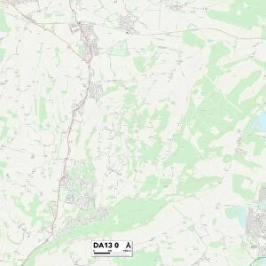
Bexley DA14 4 Map

![]()
Wall Art and Photo Gifts from Map Marketing
Bexley DA14 4 Map
Postcode Sector Map of Bexley DA14 4
Media ID 19967997
Alma Road Ash Close Aston Close Back Road Belton Road Bexley Birchwood Avenue Birkbeck Road Burnham Road Camborne Road Charles Close Church Road Clarence Road Cross Road Davenport Road Diana Close Durham Road Eaton Road Faraday Avenue Frinton Road Granville Road Harefield Road Hatherley Road High Street Highview Road Knoll Road Lansdown Road Laurel Close Lewis Road Lincoln Road Luton Road Melville Road Nelson Road Onslow Drive Parkside Princes Close Rectory Close Rectory Lane Riverside Road Rosewood Close Royal Road Selborne Road St Andrews Road St Johns Road Stanley Road The Close The Drive The Lawns Walton Road Warren Road Wren Road
FEATURES IN THESE COLLECTIONS
> Arts
> Artists
> H
> John Hillers
> Arts
> Artists
> H
> John Hills
> Europe
> United Kingdom
> England
> Durham
> Durham
> Europe
> United Kingdom
> England
> Durham
> Parkside
> Europe
> United Kingdom
> England
> Durham
> Stanley
> Europe
> United Kingdom
> England
> London
> Boroughs
> Bexley
> Europe
> United Kingdom
> Heritage Sites
> Studley Royal Park including the Ruins
> Europe
> United Kingdom
> Scotland
> Fife
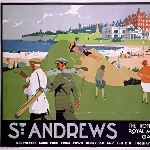
> St Andrews
> Map Marketing
> Postcode Sector Maps
> DA - Dartford
> Maps and Charts
> Related Images
MADE IN THE USA
Safe Shipping with 30 Day Money Back Guarantee
FREE PERSONALISATION*
We are proud to offer a range of customisation features including Personalised Captions, Color Filters and Picture Zoom Tools
SECURE PAYMENTS
We happily accept a wide range of payment options so you can pay for the things you need in the way that is most convenient for you
* Options may vary by product and licensing agreement. Zoomed Pictures can be adjusted in the Cart.