Home > Europe > United Kingdom > Wales > Pembrokeshire > St Davids
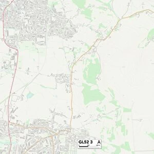
Gloucester GL2 5 Map

![]()
Wall Art and Photo Gifts from Map Marketing
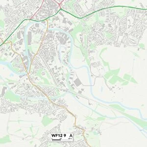
Gloucester GL2 5 Map
Postcode Sector Map of Gloucester GL2 5
Media ID 19970779
Betjeman Close Bridge Close Bristol Road Burns Avenue Byron Avenue Canal Court Chartwell Close Court Gardens Eliot Close Empire Way Gloucester Greenhill Drive Harvey Close Hathaway Close High View Hilton Close Keats Avenue Kipling Close Mansell Close Masefield Avenue Mayfair Close Milton Avenue Partridge Close Poppy Close Rectory Lane Sandalwood Drive Scott Avenue Severn Road Shakespeare Avenue Shelley Avenue St Albans Road Stirrup Close Stratford Close Tennyson Avenue The Anchorage The Forge The Gallops
FEATURES IN THESE COLLECTIONS
> Europe
> United Kingdom
> England
> Bristol
> Bristol
> Europe
> United Kingdom
> Wales
> Pembrokeshire
> St Davids
> Map Marketing
> Postcode Sector Maps
> GL - Gloucester
> Maps and Charts
> Related Images
MADE IN THE USA
Safe Shipping with 30 Day Money Back Guarantee
FREE PERSONALISATION*
We are proud to offer a range of customisation features including Personalised Captions, Color Filters and Picture Zoom Tools
SECURE PAYMENTS
We happily accept a wide range of payment options so you can pay for the things you need in the way that is most convenient for you
* Options may vary by product and licensing agreement. Zoomed Pictures can be adjusted in the Cart.