Home > Europe > United Kingdom > England > London > Boroughs > Haringey
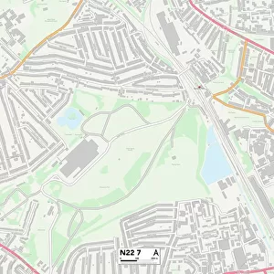
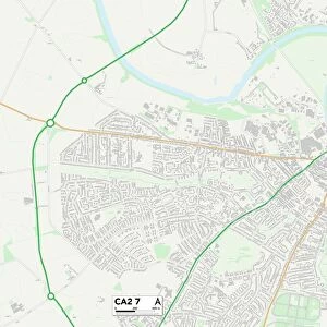
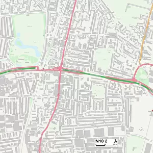
Haringey N22 6 Map

![]()
Wall Art and Photo Gifts from Map Marketing
Haringey N22 6 Map
Postcode Sector Map of Haringey N22 6
Media ID 19976123
Alexandra Road Boundary Road Bradley Road Brook Road Buller Road Bury Road Caxton Road Clarendon Road Cobham Road Crawley Road Darwin Road Frome Road Gladstone Avenue Green Lanes Haringey High Road Mark Road Meads Road Morley Avenue Parkland Road Pelham Road Redvers Road Rusper Road Russell Avenue Salisbury Road Sandringham Road Station Road Turnpike Lane Vincent Road Waldegrave Road Wellesley Road Westbury Avenue Western Road Ashley Crescent
FEATURES IN THESE COLLECTIONS
> Europe
> United Kingdom
> England
> London
> Boroughs
> Haringey
> Europe
> United Kingdom
> Northern Ireland
> County Londonderry
> Coleraine
> Map Marketing
> Postcode Sector Maps
> N - London N
> Maps and Charts
> Related Images
MADE IN THE USA
Safe Shipping with 30 Day Money Back Guarantee
FREE PERSONALISATION*
We are proud to offer a range of customisation features including Personalised Captions, Color Filters and Picture Zoom Tools
SECURE PAYMENTS
We happily accept a wide range of payment options so you can pay for the things you need in the way that is most convenient for you
* Options may vary by product and licensing agreement. Zoomed Pictures can be adjusted in the Cart.