Home > Europe > United Kingdom > Scotland > Strathclyde > Prestwick
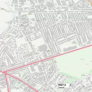
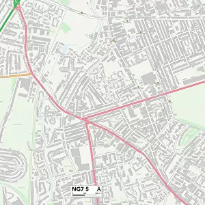
Nottingham NG8 6 Map

![]()
Wall Art and Photo Gifts from Map Marketing
Nottingham NG8 6 Map
Postcode Sector Map of Nottingham NG8 6
Media ID 19976030
Bells Lane Boswell Street Bradfield Road Bramley Road Brecon Close Broxtowe Colchester Road Colliers Way Cotswold Road Cranwell Road Eltham Close Fenwick Close Fenwick Road Frinton Road Greaves Close Halstead Close Honiton Road Lancaster Way Lawrence Drive Lime Tree Avenue Lindfield Road Main Street Moor Road Morris Road Nottingham Nottingham Road Orchard Place Phoenix Place Prestwick Close Seagrave Road Shackleton Close Shipley Road The Mount Wareham Close Westleigh Road Whitwell Close Whitwell Road Woodfield Road York Drive
FEATURES IN THESE COLLECTIONS
> Arts
> Portraits
> Pop art gallery
> Street art portraits
> Europe
> United Kingdom
> Scotland
> Strathclyde
> Prestwick
> Europe
> United Kingdom
> Wales
> Powys
> Brecon
> Map Marketing
> Postcode Sector Maps
> NG - Nottingham
> Maps and Charts
> Related Images
MADE IN THE USA
Safe Shipping with 30 Day Money Back Guarantee
FREE PERSONALISATION*
We are proud to offer a range of customisation features including Personalised Captions, Color Filters and Picture Zoom Tools
SECURE PAYMENTS
We happily accept a wide range of payment options so you can pay for the things you need in the way that is most convenient for you
* Options may vary by product and licensing agreement. Zoomed Pictures can be adjusted in the Cart.