Home > Arts > Portraits > Pop art gallery > Street art portraits
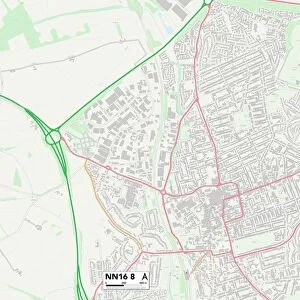
Northampton NN1 4 Map

![]()
Wall Art and Photo Gifts from Map Marketing
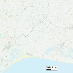
Northampton NN1 4 Map
Postcode Sector Map of Northampton NN1 4
Media ID 19975896
Alexandra Road Allen Road Ashburnham Road Birchfield Road Broadway Brookland Road Brunswick Place Cedar Road Clarke Road Collingwood Road Collins Street Derby Road East Street Ethel Street Florence Road Henry Street Holly Road Hood Street Ivy Road Lea Road Market Street Melbourne Street Melville Street Northampton Oakwood Road Pavilion Court Percy Road Perry Street Portland Place Raglan Street St Edmunds Road St Michaels Avenue St Michaels Mount Talbot Road The Crescent The Drive The Vale Turner Street Vernon Street Wantage Road West Street Whitworth Road Bouverie Street
FEATURES IN THESE COLLECTIONS
> Arts
> Portraits
> Pop art gallery
> Street art portraits
> Map Marketing
> Postcode Sector Maps
> NN - Northampton
> Maps and Charts
> Related Images
MADE IN THE USA
Safe Shipping with 30 Day Money Back Guarantee
FREE PERSONALISATION*
We are proud to offer a range of customisation features including Personalised Captions, Color Filters and Picture Zoom Tools
SECURE PAYMENTS
We happily accept a wide range of payment options so you can pay for the things you need in the way that is most convenient for you
* Options may vary by product and licensing agreement. Zoomed Pictures can be adjusted in the Cart.