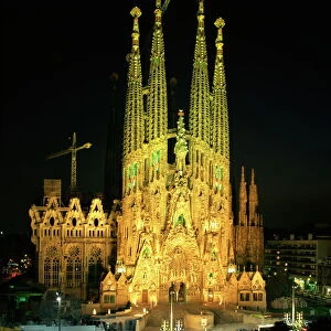
Home > Europe > United Kingdom > Wales > Ceredigion > Cardigan
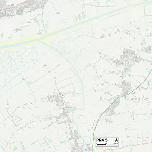
Preston PR2 2 Map

![]()
Wall Art and Photo Gifts from Map Marketing
Preston PR2 2 Map
Postcode Sector Map of Preston PR2 2
Media ID 19978230
Abbey Street Admiral Way Ashton Street Atherton Close Bath Street Belmont Road Beverley Close Blackpool Road Blanche Street Bridge Road Brierley Street Britannia Drive Cardigan Street Carlton Street Clovelly Avenue Colenso Road Coniston Avenue Douglas Street Endeavour Close Evans Street Ferry Road Francis Street Grange Road Haig Avenue Hall Street Hampton Street Hardy Close Hesketh Street Holme Road Inkerman Street Junction Road Kimberley Road Ladysmith Road Lowther Street Lulworth Avenue Lytham Close Lytham Road Mafeking Road Mariners Way Markham Street Mountbatten Close Navigation Way Nelson Way Parker Street Parkfield Avenue Peel Street Plant Street Plumpton Road Port Way Preston Priory Street Raglan Street Ridley Road Rose Avenue Shelley Road Steeple View Stocks Road The Cloisters The Ferns The Pavilions Trafalgar Close Water Lane Waterloo Road Weston Street Windsor Avenue Hanbury Street Hull Street
FEATURES IN THESE COLLECTIONS
> Animals
> Mammals
> Muridae
> Water Mouse
> Arts
> Artists
> D
> Francis Drake
> Arts
> Artists
> P
> Francis Place
> Arts
> Portraits
> Pop art gallery
> Street art portraits
> Europe
> United Kingdom
> Wales
> Ceredigion
> Cardigan
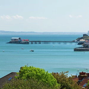
> Europe
> United Kingdom
> Wales
> West Glamorgan
> Swansea
> Map Marketing
> Postcode Sector Maps
> PR - Preston
> Maps and Charts
> Related Images
MADE IN THE USA
Safe Shipping with 30 Day Money Back Guarantee
FREE PERSONALISATION*
We are proud to offer a range of customisation features including Personalised Captions, Color Filters and Picture Zoom Tools
SECURE PAYMENTS
We happily accept a wide range of payment options so you can pay for the things you need in the way that is most convenient for you
* Options may vary by product and licensing agreement. Zoomed Pictures can be adjusted in the Cart.