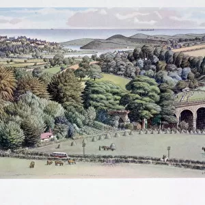
Home > Animals > Birds > Passerines > Finches > Brambling
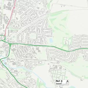
Sheffield S35 9 Map

![]()
Wall Art and Photo Gifts from Map Marketing
Sheffield S35 9 Map
Postcode Sector Map of Sheffield S35 9
Media ID 19978932
Church Street Cross Hill Green Lane High Street Hilton Drive Linden Court Linden Road Mill Court Mill Road Minster Close Minster Road Nether Lane Nursery Drive Nursery Grove Orchard Close Park Crescent Primrose Drive Priory Close Priory Road Sheffield St Margarets Road St Marys Close St Marys Lane St Michaels Close St Michaels Crescent St Michaels Road Station Road Stocks Hill Sycamore Road The Brambles The Common Washington Road Well Lane Wordsworth Avenue Ecclesfield
FEATURES IN THESE COLLECTIONS
> Animals
> Birds
> Passerines
> Finches
> Brambling
> Map Marketing
> Postcode Sector Maps
> S - Sheffield
MADE IN THE USA
Safe Shipping with 30 Day Money Back Guarantee
FREE PERSONALISATION*
We are proud to offer a range of customisation features including Personalised Captions, Color Filters and Picture Zoom Tools
SECURE PAYMENTS
We happily accept a wide range of payment options so you can pay for the things you need in the way that is most convenient for you
* Options may vary by product and licensing agreement. Zoomed Pictures can be adjusted in the Cart.