Home > Europe > United Kingdom > England > London > Boroughs > Hillingdon
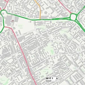
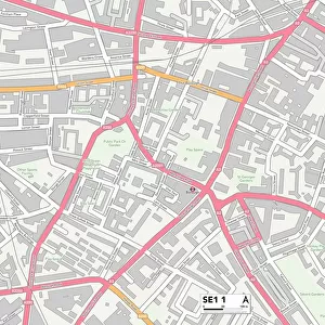
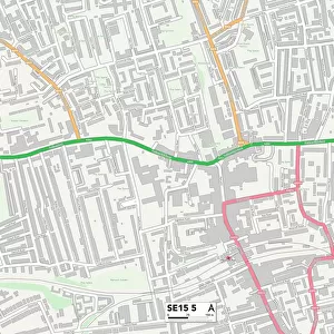
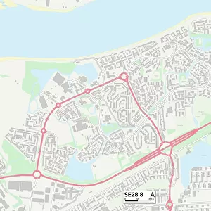
Southwark SE17 3 Map

![]()
Wall Art and Photo Gifts from Map Marketing
Southwark SE17 3 Map
Postcode Sector Map of Southwark SE17 3
Media ID 19981760
Angel Lane Carter Street Cooks Road Copley Close Dale Road Empress Street Fielding Street Fleming Road Frederick Road Hampton Street Harding Close Langdale Close Manor Place Newington Occupation Road Royal Road Southwark St Pauls Terrace Westcott Road Alberta Street Gateway Kennington Se17
FEATURES IN THESE COLLECTIONS
> Animals
> Fishes
> S
> Sturgeon
> Arts
> Artists
> C
> Paul Carter
> Arts
> Artists
> H
> Harding Harding
> Arts
> Portraits
> Pop art gallery
> Street art portraits
> Europe
> United Kingdom
> England
> London
> Boroughs
> Hillingdon
> Europe
> United Kingdom
> England
> London
> Boroughs
> Southwark
> Europe
> United Kingdom
> Scotland
> Sutherland
> Map Marketing
> Postcode Sector Maps
> SE - London SE
> Maps and Charts
> Related Images
MADE IN THE USA
Safe Shipping with 30 Day Money Back Guarantee
FREE PERSONALISATION*
We are proud to offer a range of customisation features including Personalised Captions, Color Filters and Picture Zoom Tools
SECURE PAYMENTS
We happily accept a wide range of payment options so you can pay for the things you need in the way that is most convenient for you
* Options may vary by product and licensing agreement. Zoomed Pictures can be adjusted in the Cart.