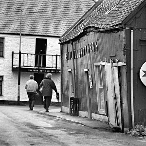
Home > Europe > United Kingdom > Wales > Pembrokeshire > St Davids
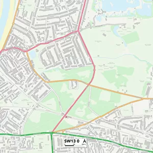
Slough SL3 0 Map

![]()
Wall Art and Photo Gifts from Map Marketing
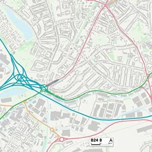
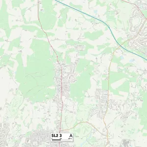
Slough SL3 0 Map
Postcode Sector Map of Slough SL3 0
Media ID 19978836
Aintree Close Arkwright Road Bath Road Beacon Court Blackthorne Road Bridge Street Brookside Coleridge Crescent David Road Foundry Lane High Street Horton Horton Road Ingleside Lakeside Road Laurel Close Meadowbrook Close Mill Street Milton Close Myrtle Close Park Street Poplar Close Raymond Close Sherborne Close Slough Stanwell Road Tall Trees The Hawthorns Vicarage Way Willow Close Willow Road Winchester Close
FEATURES IN THESE COLLECTIONS
> Arts
> Portraits
> Pop art gallery
> Street art portraits
> Europe
> United Kingdom
> Wales
> Pembrokeshire
> St Davids
> Map Marketing
> Postcode Sector Maps
> SL - Slough
> Maps and Charts
> Related Images
MADE IN THE USA
Safe Shipping with 30 Day Money Back Guarantee
FREE PERSONALISATION*
We are proud to offer a range of customisation features including Personalised Captions, Color Filters and Picture Zoom Tools
SECURE PAYMENTS
We happily accept a wide range of payment options so you can pay for the things you need in the way that is most convenient for you
* Options may vary by product and licensing agreement. Zoomed Pictures can be adjusted in the Cart.