Home > Europe > United Kingdom > England > Buckinghamshire > Denham
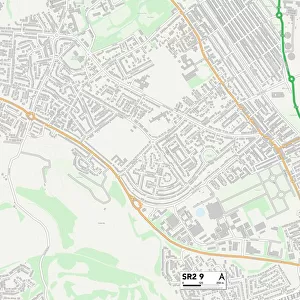
South Buckinghamshire SL0 0 Map

![]()
Wall Art and Photo Gifts from Map Marketing
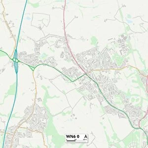
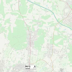
South Buckinghamshire SL0 0 Map
Postcode Sector Map of South Buckinghamshire SL0 0
Media ID 19981154
Alder Road Ashford Road Birch Close Bond Close Cedar Close Church Road Denham Road Firs Close Grosvenor Close Hardings Close Hawthorn Close Heath Way Hollybush Lane Honeysuckle Close Linden Close Longstone Road Norwood Lane Old Orchard Pinewood Close Pinewood Road Riverside Way Rowan Gardens Slough Road South Buckinghamshire St Davids Close St Margarets Close Swallow Street Swallowdale The Close The Parkway Uxbridge Road Whitehouse Way Wood Lane Iver Heath Martindale
FEATURES IN THESE COLLECTIONS
> Animals
> Birds
> Passerines
> Starlings
> Related Images
> Animals
> Fishes
> S
> Swallower
> Animals
> Mammals
> Muridae
> Heath Mouse
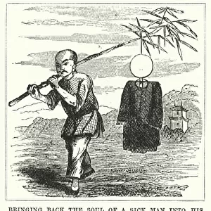
> Arts
> Artists
> H
> Harding Harding
> Arts
> Portraits
> Pop art gallery
> Street art portraits
> Europe
> United Kingdom
> England
> Buckinghamshire
> Denham
> Europe
> United Kingdom
> England
> Buckinghamshire
> Related Images
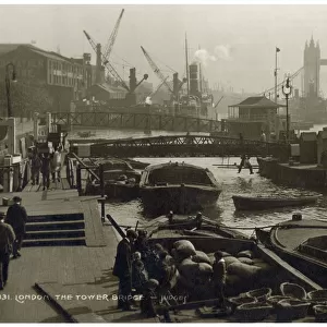
> Europe
> United Kingdom
> Northern Ireland
> County Down
> Bangor
> Europe
> United Kingdom
> Northern Ireland
> County Down
> Rostrevor
> Europe
> United Kingdom
> Wales
> Gwynedd
> Bangor
> Map Marketing
> Postcode Sector Maps
> SL - Slough
MADE IN THE USA
Safe Shipping with 30 Day Money Back Guarantee
FREE PERSONALISATION*
We are proud to offer a range of customisation features including Personalised Captions, Color Filters and Picture Zoom Tools
SECURE PAYMENTS
We happily accept a wide range of payment options so you can pay for the things you need in the way that is most convenient for you
* Options may vary by product and licensing agreement. Zoomed Pictures can be adjusted in the Cart.