Home > Europe > United Kingdom > England > London > Sights > Victoria Park
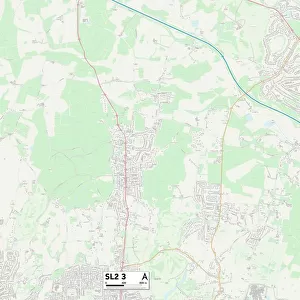
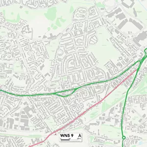
South Buckinghamshire SL0 9 Map

![]()
Wall Art and Photo Gifts from Map Marketing
South Buckinghamshire SL0 9 Map
Postcode Sector Map of South Buckinghamshire SL0 9
Media ID 19981184
Addison Close Barnes Way Barnfield Blythe Close Cecil Road Cherry Close Court Lane Donkey Lane Ford Lane Grange Way High Street Kings Way Leacroft Road Love Lane Main Drive Marina Way Norfolk Close North Park Reed Close Ridge Way Somerset Way South Buckinghamshire Swan Road The Common The Ridings Victoria Crescent Ward Close Wellesley Avenue Iver Thorney
FEATURES IN THESE COLLECTIONS
> Animals
> Farm
> Donkeys
> Related Images
> Arts
> Artists
> W
> James Ward
> Arts
> Portraits
> Pop art gallery
> Street art portraits
> Europe
> United Kingdom
> England
> Buckinghamshire
> Related Images
> Europe
> United Kingdom
> England
> London
> Sights
> St James Park
> Europe
> United Kingdom
> England
> London
> Sights
> Victoria Park
> Europe
> United Kingdom
> England
> Norfolk
> High Green
> Europe
> United Kingdom
> England
> Norfolk
> Langley Street
> Europe
> United Kingdom
> England
> Norfolk
> North Green
> Europe
> United Kingdom
> England
> Norfolk
> Related Images
> Map Marketing
> Postcode Sector Maps
> SL - Slough
MADE IN THE USA
Safe Shipping with 30 Day Money Back Guarantee
FREE PERSONALISATION*
We are proud to offer a range of customisation features including Personalised Captions, Color Filters and Picture Zoom Tools
SECURE PAYMENTS
We happily accept a wide range of payment options so you can pay for the things you need in the way that is most convenient for you
* Options may vary by product and licensing agreement. Zoomed Pictures can be adjusted in the Cart.