Home > Europe > United Kingdom > Wales > Ceredigion > New Quay
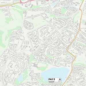
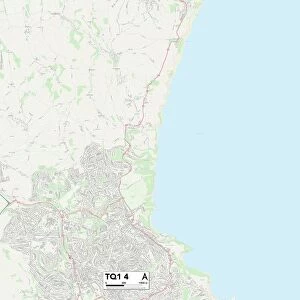
Torbay TQ5 8 Map

![]()
Wall Art and Photo Gifts from Map Marketing
Torbay TQ5 8 Map
Postcode Sector Map of Torbay TQ5 8
Media ID 19979192
Alma Road Bank Lane Brookdale Close Cambridge Road Church Street Fore Street Furze Lane Heather Way Higher Street Highfield Close Lakes Road Lavender Close Lichfield Close Lichfield Drive Market Street Meadow Park Middle Street Nelson Road New Road Oxford Lane Prospect Road Pump Street Queens Road Sanders Road Station Hill The Close The Quay The Strand Torbay Union Lane Vicarage Close Vicarage Hill Wayside Wayside Close Brixham
FEATURES IN THESE COLLECTIONS
> Arts
> Portraits
> Pop art gallery
> Street art portraits
> Europe
> United Kingdom
> England
> Cumberland
> Europe
> United Kingdom
> Wales
> Ceredigion
> New Quay
> Map Marketing
> Postcode Sector Maps
> TQ - Torquay
> Maps and Charts
> Related Images
MADE IN THE USA
Safe Shipping with 30 Day Money Back Guarantee
FREE PERSONALISATION*
We are proud to offer a range of customisation features including Personalised Captions, Color Filters and Picture Zoom Tools
SECURE PAYMENTS
We happily accept a wide range of payment options so you can pay for the things you need in the way that is most convenient for you
* Options may vary by product and licensing agreement. Zoomed Pictures can be adjusted in the Cart.