Home > Europe > United Kingdom > England > Durham > Station Town
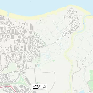
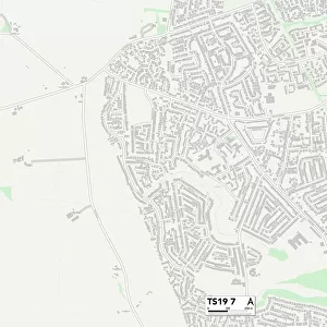
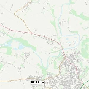
County Durham TS28 5 Map

![]()
Wall Art and Photo Gifts from Map Marketing
County Durham TS28 5 Map
Postcode Sector Map of County Durham TS28 5
Media ID 19980042
Chapel Street Church Street Coronation Road County Durham Durham Road Ferndale Close Forest Gate Front Street Kings Road Moor Lane New Cross Road North Road Pickering Street Queens Road Salters Lane Sandford Close Station Lane Station Road Stewart Drive The Firs Wellfield Road Woodland View Wingate
FEATURES IN THESE COLLECTIONS
> Arts
> Landscape paintings
> Forest and woodland scenes
> Forest artwork
> Arts
> Portraits
> Pop art gallery
> Street art portraits
> Europe
> United Kingdom
> England
> County Durham
> Durham
> Europe
> United Kingdom
> England
> Durham
> Durham
> Europe
> United Kingdom
> England
> Durham
> Greenhill
> Europe
> United Kingdom
> England
> Durham
> Station Town
> Europe
> United Kingdom
> England
> Durham
> Wingate
> Europe
> United Kingdom
> England
> Durham
> Woodland
> Map Marketing
> Postcode Sector Maps
> TS - Middlesbrough
> Maps and Charts
> Related Images
MADE IN THE USA
Safe Shipping with 30 Day Money Back Guarantee
FREE PERSONALISATION*
We are proud to offer a range of customisation features including Personalised Captions, Color Filters and Picture Zoom Tools
SECURE PAYMENTS
We happily accept a wide range of payment options so you can pay for the things you need in the way that is most convenient for you
* Options may vary by product and licensing agreement. Zoomed Pictures can be adjusted in the Cart.