Home > Maps and Charts > Related Images
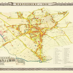
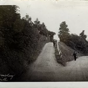
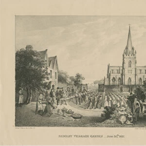
Old Map of the Collieries of Tipton, Sedgley and Wednesbury 1848

![]()
Wall Art and Photo Gifts from MapSeeker
Old Map of the Collieries of Tipton, Sedgley and Wednesbury 1848
PL005
Welcome to the Mapseeker Image library and enter an historic gateway to one of the largest on-line collections of Historic Maps, Nostalgic Views, Vista's and Panorama's from a World gone by.
Media ID 20346925
Historic Map Old Town Plan Town Plan Sedgley Tipton Wednesbury
FEATURES IN THESE COLLECTIONS
> Maps and Charts
> Related Images
> MapSeeker
> British Town And City Plans
> English & Welsh PORTFOLIO
EDITORS COMMENTS
This print showcases an exquisite piece of history - the Old Map of the Collieries of Tipton, Sedgley, and Wednesbury from 1848. Stepping back in time, this map offers a fascinating glimpse into the industrial landscape that once defined these towns. With intricate details and meticulous craftsmanship, this old map provides a comprehensive overview of Tipton's, Sedgley's, and Wednesbury's collieries during their heyday. It unravels the interconnected web of mining operations that fueled these communities' growth and prosperity. The town plans featured on this historic map offer insight into how Tipton, Sedgley, and Wednesbury were structured in the mid-19th century. From bustling streets to prominent landmarks, every corner is meticulously depicted with precision. As we observe this remarkable artifact today, it serves as a reminder of our rich heritage and how far we have come since those coal-mining days. This photograph allows us to appreciate the industrious spirit that shaped these towns while also acknowledging their transformation over time. Whether you are a history enthusiast or simply curious about your local area's past, this print will transport you back to an era when coal was king and these three towns thrived amidst their colliery-driven economies. Let yourself be captivated by the charm and historical significance encapsulated within this Old Map of Tipton, Sedgley, and Wednesbury from 1848.
MADE IN THE USA
Safe Shipping with 30 Day Money Back Guarantee
FREE PERSONALISATION*
We are proud to offer a range of customisation features including Personalised Captions, Color Filters and Picture Zoom Tools
SECURE PAYMENTS
We happily accept a wide range of payment options so you can pay for the things you need in the way that is most convenient for you
* Options may vary by product and licensing agreement. Zoomed Pictures can be adjusted in the Cart.