Home > Europe > United Kingdom > England > London > Boroughs > Lambeth
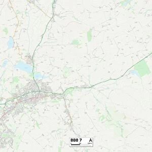
Pendle BB8 7 Map

![]()
Wall Art and Photo Gifts from Map Marketing
Pendle BB8 7 Map
Postcode Sector Map of Pendle BB8 7
Media ID 19965658
Alma Avenue Alma Road Bent Lane Blenheim Street Buttercup Close Buttermere Avenue Castle Court Castle Road Causeway Chapel Street Clarendon Street Coniston Grove Craven Street Cromwell Street Derwent Close Devon Street Grasmere Close High Lane Highfield Avenue Hill Lane Holme Street Keighley Road Kingsley Road Long Lane Lynwood Close Manor Road Meadow Close Monmouth Street Parkinson Street Pasture Drive Pendle Railway Street Red Lane Regent Avenue Robinson Street School Lane Sheridan Road Skipton Road Smithy Lane Station Road Stoney Lane Sycamore Gardens Sycamore Rise The Croft The Meadows Thirlmere Avenue Towngate Vernon Road Windermere Avenue Cranbourne Street
FEATURES IN THESE COLLECTIONS
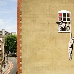
> Arts
> Artists
> B
> William Brown
> Arts
> Portraits
> Pop art gallery
> Street art portraits
> Europe
> United Kingdom
> England
> Devon
> Hartley
> Europe
> United Kingdom
> England
> Devon
> Related Images
> Europe
> United Kingdom
> England
> London
> Boroughs
> Lambeth
> Europe
> United Kingdom
> Heritage Sites
> Derwent Valley Mills
> Europe
> United Kingdom
> Wales
> Monmouthshire
> Monmouth
> Map Marketing
> Postcode Sector Maps
> BB - Blackburn
> Maps and Charts
> Related Images
> North America
> United States of America
> New York
> New York
> Sights
> Wall Street
> Popular Themes
> Devon
MADE IN THE USA
Safe Shipping with 30 Day Money Back Guarantee
FREE PERSONALISATION*
We are proud to offer a range of customisation features including Personalised Captions, Color Filters and Picture Zoom Tools
SECURE PAYMENTS
We happily accept a wide range of payment options so you can pay for the things you need in the way that is most convenient for you
* Options may vary by product and licensing agreement. Zoomed Pictures can be adjusted in the Cart.