Home > Europe > United Kingdom > England > Somerset > Christon
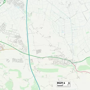
Somerset BS29 6 Map

![]()
Wall Art and Photo Gifts from Map Marketing
Somerset BS29 6 Map
Postcode Sector Map of Somerset BS29 6
Media ID 19967338
Ash Road Banwell Road Castle Hill Chesterfield Close Chestnut Close Church Street Cooks Lane Coronation Road Dark Lane East Street Elm Close Gables Close Greenfields Avenue Grove Road High Street Moor Road New Road North Road Orchard Close Park End Queens Road Riverside School Close Somerset Springfield Gardens Summer Lane The Paddock Well Lane West Street Westfield Crescent Westfield Road Willow Lane
FEATURES IN THESE COLLECTIONS
> Animals
> Insects
> Spiders
> Silver Garden
> Arts
> Portraits
> Pop art gallery
> Street art portraits
> Europe
> United Kingdom
> England
> Somerset
> Ash
> Europe
> United Kingdom
> England
> Somerset
> Banwell
> Europe
> United Kingdom
> England
> Somerset
> Christon
> Europe
> United Kingdom
> England
> Somerset
> Related Images
> Europe
> United Kingdom
> England
> Somerset
> Street
> Europe
> United Kingdom
> England
> Somerset
> Wells
> Map Marketing
> Postcode Sector Maps
> BS - Bristol
> Maps and Charts
> Related Images
MADE IN THE USA
Safe Shipping with 30 Day Money Back Guarantee
FREE PERSONALISATION*
We are proud to offer a range of customisation features including Personalised Captions, Color Filters and Picture Zoom Tools
SECURE PAYMENTS
We happily accept a wide range of payment options so you can pay for the things you need in the way that is most convenient for you
* Options may vary by product and licensing agreement. Zoomed Pictures can be adjusted in the Cart.