Home > Europe > United Kingdom > England > London > Boroughs > Camden
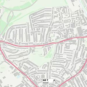
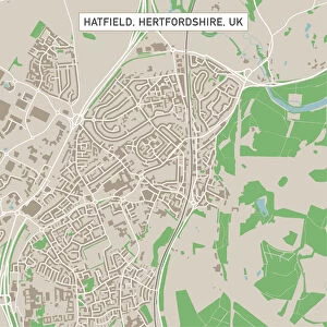
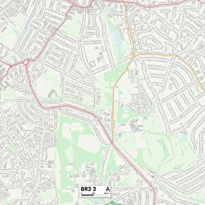
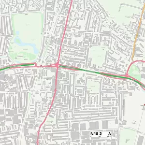
Camden N6 5 Map

![]()
Wall Art and Photo Gifts from Map Marketing
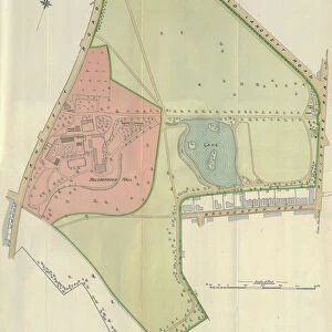
Camden N6 5 Map
Postcode Sector Map of Camden N6 5
Media ID 19975691
Archway Road Avenue Road Bloomfield Road Camden Claremont Road Cromwell Avenue Cromwell Place Highgate Hillside Gardens Holmesdale Road Hurst Avenue Jacksons Lane Kingsley Place Milton Avenue Milton Park Milton Road Northwood Road Orchard Road Parklands Priory Gardens Ridgeway Gardens Ridings Close Shepherds Close Shepherds Hill Somerset Gardens South Grove Southwood Avenue Stanhope Gardens Stanhope Road The Bank Tudor Close Winchester Road Wood Lane Castle Yard Winchester Place
FEATURES IN THESE COLLECTIONS
> Arts
> Portraits
> Pop art gallery
> Street art portraits
> Europe
> United Kingdom
> England
> London
> Boroughs
> Camden
> Europe
> United Kingdom
> England
> Somerset
> Related Images
> Europe
> United Kingdom
> England
> Somerset
> Southwood
> Europe
> United Kingdom
> England
> Somerset
> Street
> Europe
> United Kingdom
> Wales
> Flintshire
> Broughton
> Map Marketing
> Postcode Sector Maps
> N - London N
> Map Marketing
> UK Maps
> Maps and Charts
> Related Images
MADE IN THE USA
Safe Shipping with 30 Day Money Back Guarantee
FREE PERSONALISATION*
We are proud to offer a range of customisation features including Personalised Captions, Color Filters and Picture Zoom Tools
SECURE PAYMENTS
We happily accept a wide range of payment options so you can pay for the things you need in the way that is most convenient for you
* Options may vary by product and licensing agreement. Zoomed Pictures can be adjusted in the Cart.