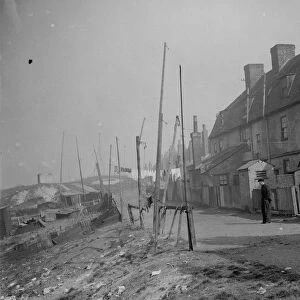
Home > Europe > United Kingdom > England > Northumberland > Broomhill
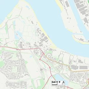
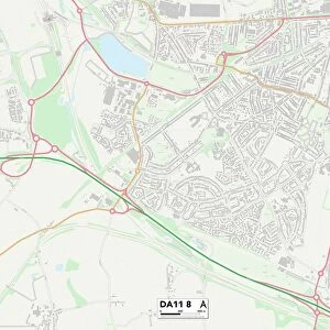
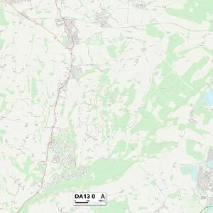
Gravesham DA13 9 Map

![]()
Wall Art and Photo Gifts from Map Marketing
Gravesham DA13 9 Map
Postcode Sector Map of Gravesham DA13 9
Media ID 19967999
Baker Close Bramley Close Brookside Road Castlefields Chequers Close Church Road Church Street Dale Road Downs Road Fairview Road Gravesham Haven Close Hill Close Lewis Road Little Croft Long Walk Manor Road Monks Walk New Barn Road Northumberland Road Park Hill Rectory Meadow Sandy Lane Station Road The Beeches Warren Road Weald Close Westwood Westwood Road Whitehill Road Worcester Close Wrotham Road Meopham Sedley
FEATURES IN THESE COLLECTIONS
> Arts
> Portraits
> Pop art gallery
> Street art portraits
> Europe
> United Kingdom
> England
> Northumberland
> Broomhill
> Europe
> United Kingdom
> England
> Northumberland
> Related Images
> Map Marketing
> Postcode Sector Maps
> DA - Dartford
> Maps and Charts
> Related Images
MADE IN THE USA
Safe Shipping with 30 Day Money Back Guarantee
FREE PERSONALISATION*
We are proud to offer a range of customisation features including Personalised Captions, Color Filters and Picture Zoom Tools
SECURE PAYMENTS
We happily accept a wide range of payment options so you can pay for the things you need in the way that is most convenient for you
* Options may vary by product and licensing agreement. Zoomed Pictures can be adjusted in the Cart.