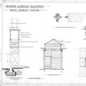
Home > Europe > United Kingdom > England > London > Boroughs > Bromley
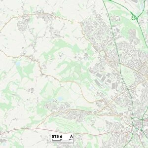
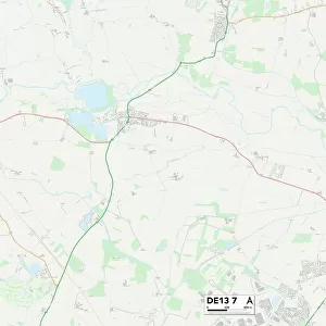
East Staffordshire DE13 7 Map

![]()
Wall Art and Photo Gifts from Map Marketing
East Staffordshire DE13 7 Map
Postcode Sector Map of East Staffordshire DE13 7
Media ID 19969565
All Saints Lane Anson Road Audley Close Beech Avenue Broome Close Burton Road Chamberlain Close Church Lane Church Road Churchill Crescent Cotton Close Daisy Lane Dark Lane East Staffordshire Exchange Road Fox Court Fox Lane Foxton Close Furlong Close Furlong Lane Kings Walk Lichfield Road Main Street Manor Fields Manor Road Manor Walk Myers Lane Newton Lane Oakfield Road Park Road Poppy Gardens Post Office Road Selwyn Close Somerville Road The Croft The Grange The Moorings Vicarage Lane Wellfield Road
FEATURES IN THESE COLLECTIONS
> Arts
> Artists
> B
> William Bromley
> Arts
> Artists
> F
> Newton Fielding
> Arts
> Artists
> H
> William Hart
> Arts
> Artists
> M
> William Mellor
> Arts
> Artists
> W
> William White
> Arts
> Portraits
> Pop art gallery
> Street art portraits
> Europe
> United Kingdom
> England
> London
> Boroughs
> Bromley
> Europe
> United Kingdom
> England
> London
> Sights
> Victoria Park
> Europe
> United Kingdom
> England
> Staffordshire
> Alrewas
> Europe
> United Kingdom
> England
> Staffordshire
> Audley
> Map Marketing
> Postcode Sector Maps
> DE - Derby
MADE IN THE USA
Safe Shipping with 30 Day Money Back Guarantee
FREE PERSONALISATION*
We are proud to offer a range of customisation features including Personalised Captions, Color Filters and Picture Zoom Tools
SECURE PAYMENTS
We happily accept a wide range of payment options so you can pay for the things you need in the way that is most convenient for you
* Options may vary by product and licensing agreement. Zoomed Pictures can be adjusted in the Cart.