Home > Europe > United Kingdom > England > London > Boroughs > Newham
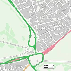
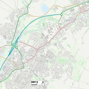
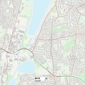
Newham E6 6 Map

![]()
Wall Art and Photo Gifts from Map Marketing
Newham E6 6 Map
Postcode Sector Map of Newham E6 6
Media ID 19970181
Alexandra Road Arthur Road Brighton Road County Road Eastbourne Road Eastbury Road Elderberry Way Fleet Road Folkestone Road Gresham Road Harebell Drive Hillcroft Road Howard Road Johnstone Road Langton Avenue Mountfield Road Newham Norman Road North Circular Road St Albans Avenue Tilbury Road Vicarage Lane Weymouth Close Wheatfields White Horse Road Wolsey Avenue Beaufort Downings East Ham Hide Stonewall Sudbury
FEATURES IN THESE COLLECTIONS
> Animals
> Farm
> Cattle
> Related Images
> Animals
> Fishes
> W
> Whiting
> Arts
> Artists
> H
> Henry Howard
> Europe
> United Kingdom
> England
> London
> Boroughs
> Newham
> Europe
> United Kingdom
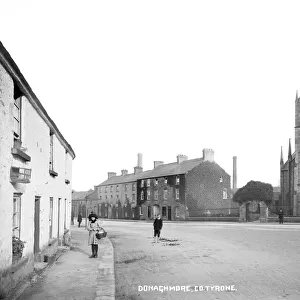
> Northern Ireland
> County Tyrone
> Related Images
> Europe
> United Kingdom
> Northern Ireland
> County Down
> Related Images
> Europe
> United Kingdom
> Northern Ireland
> Tyrone
> Europe
> United Kingdom
> Scotland
> Strathclyde
> Johnstone
> Map Marketing
> Postcode Sector Maps
> E - London E
> Maps and Charts
> Related Images
MADE IN THE USA
Safe Shipping with 30 Day Money Back Guarantee
FREE PERSONALISATION*
We are proud to offer a range of customisation features including Personalised Captions, Color Filters and Picture Zoom Tools
SECURE PAYMENTS
We happily accept a wide range of payment options so you can pay for the things you need in the way that is most convenient for you
* Options may vary by product and licensing agreement. Zoomed Pictures can be adjusted in the Cart.