Home > Europe > United Kingdom > England > London > Politics > John Russell
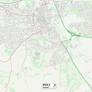
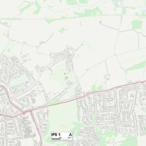
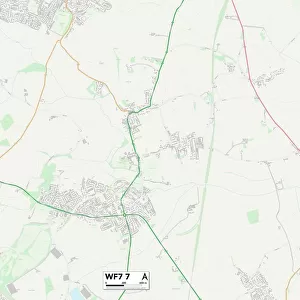
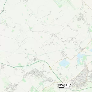
Wycombe HP10 8 Map

![]()
Wall Art and Photo Gifts from Map Marketing
Wycombe HP10 8 Map
Postcode Sector Map of Wycombe HP10 8
Media ID 19972042
Ashley Drive Bank Road Beacon Hill Birch Way Burrows Close Cherry Tree Way Chilton Close Church Road Cock Lane Crown Lane Elm Road Glebelands Hawthorn Place Hillcroft Road Hillside Road Katherine Close Kings Ride Kingswood Avenue Kingswood Road Larch Close Manor Road Meadow Walk New Road Nursery Lane Oaktree Close Russell Close School Road Silverdale Close St Johns Avenue St Johns Close St Johns Road St Margarets Close Stretton Close The Chase The Dell The Glade The Greenway The Lawns The Pines The Spinneys The Thicket West Avenue Whitehouse Lane Woodside Way Wycombe Penn
FEATURES IN THESE COLLECTIONS
> Animals
> Birds
> Passerines
> Finches
> Related Images
> Arts
> Artists
> C
> John Carter
> Arts
> Artists
> C
> Paul Carter
> Arts
> Artists
> H
> John Hillers
> Arts
> Artists
> H
> John Hills
> Arts
> Artists
> P
> John Pine
> Arts
> Artists
> R
> John Russell
> Arts
> Artists
> W
> John Wood
> Europe
> United Kingdom
> England
> London
> Politics
> John Russell
> Map Marketing
> Postcode Sector Maps
> HP - Hemel Hempstead
> Maps and Charts
> Related Images
MADE IN THE USA
Safe Shipping with 30 Day Money Back Guarantee
FREE PERSONALISATION*
We are proud to offer a range of customisation features including Personalised Captions, Color Filters and Picture Zoom Tools
SECURE PAYMENTS
We happily accept a wide range of payment options so you can pay for the things you need in the way that is most convenient for you
* Options may vary by product and licensing agreement. Zoomed Pictures can be adjusted in the Cart.