Home > Europe > United Kingdom > Wales > Pembrokeshire > Pembroke
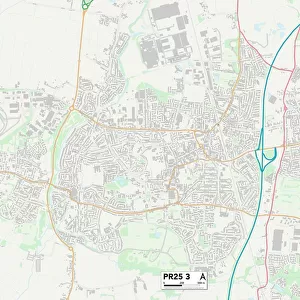
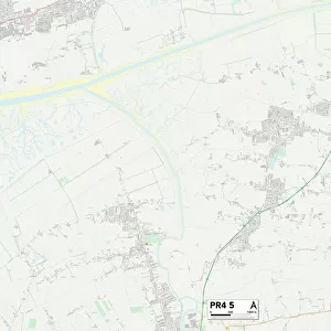
South Ribble PR25 2 Map

![]()
Wall Art and Photo Gifts from Map Marketing
South Ribble PR25 2 Map
Postcode Sector Map of South Ribble PR25 2
Media ID 19976730
Argyle Road Balfour Street Belgrave Court Belgrave Road Broad Street Broadfield Brownhill Road Carlton Road Chatsworth Road Eastwood Road Eden Street Edward Street Fairfield Road Forge Street Forrester Close Haig Avenue Headley Road Heaton Street High Green Hough Lane John Street King Street Kingswood Road Low Green Meadow Street Mosley Street North View Northbrook Road Northcote Street Oak View Pembroke Place Poppy Close Regent Road Ryan Close Sandy Lane School Lane South Ribble South View Terrace Southbrook Road Spring Gardens St Andrews Way Sumner Street Talbot Road Thurston Road Towngate Wellfield Avenue Westgate Wood Green Woodlands Drive Woodlea Road Leyland
FEATURES IN THESE COLLECTIONS
> Arts
> Artists
> H
> John Hillers
> Arts
> Artists
> H
> John Hills
> Arts
> Artists
> W
> John Wood
> Arts
> Portraits
> Pop art gallery
> Street art portraits
> Europe
> United Kingdom
> Scotland
> Fife
> St Andrews
> Europe
> United Kingdom
> Wales
> Pembrokeshire
> Pembroke
> Map Marketing
> Postcode Sector Maps
> PR - Preston
> Maps and Charts
> Related Images
MADE IN THE USA
Safe Shipping with 30 Day Money Back Guarantee
FREE PERSONALISATION*
We are proud to offer a range of customisation features including Personalised Captions, Color Filters and Picture Zoom Tools
SECURE PAYMENTS
We happily accept a wide range of payment options so you can pay for the things you need in the way that is most convenient for you
* Options may vary by product and licensing agreement. Zoomed Pictures can be adjusted in the Cart.