Home > Europe > United Kingdom > England > Northumberland > Halton
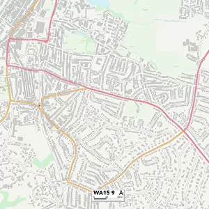
Halton WA8 5 Map

![]()
Wall Art and Photo Gifts from Map Marketing
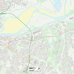
Halton WA8 5 Map
Postcode Sector Map of Halton WA8 5
Media ID 19979866
Alder Lane Black Horse Lane Brook Close Church View Close Churchfields Forge Close Hall Lane Halton Hampton Drive Hartland Close Mansell Close Mill Lane Northumberland Road Penny Lane Prescot Road Sandy Lane Smithy Close Smithy Lane The Ridgeway Wheatfield Road Woburn Drive
FEATURES IN THESE COLLECTIONS
> Animals
> Mammals
> Muridae
> Heath Mouse
> Europe
> United Kingdom
> England
> Northumberland
> Halton
> Europe
> United Kingdom
> England
> Northumberland
> Related Images
> Map Marketing
> Postcode Sector Maps
> WA - Warrington
> Maps and Charts
> Related Images
MADE IN THE USA
Safe Shipping with 30 Day Money Back Guarantee
FREE PERSONALISATION*
We are proud to offer a range of customisation features including Personalised Captions, Color Filters and Picture Zoom Tools
SECURE PAYMENTS
We happily accept a wide range of payment options so you can pay for the things you need in the way that is most convenient for you
* Options may vary by product and licensing agreement. Zoomed Pictures can be adjusted in the Cart.