Home > Animals > Mammals > Bovidae > Ox
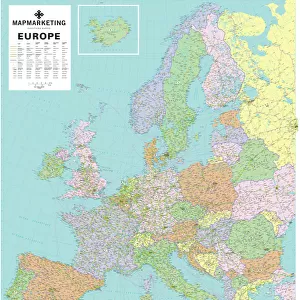
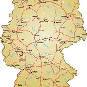
European Postcode Map

![]()
Wall Art and Photo Gifts from Map Marketing
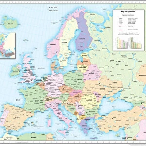
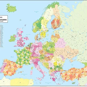
European Postcode Map
This colour European Postcode business map covers all of Europe from Norway in the north to Crete in the south and from Portugal in the west through to Azerbaijan in the east. Within each country the primary section of the Postcode is highlighted by coloured blocks and annotated. The UK is shown to Postcode Area level (e.g. OX) with an inset for the Greater London area. The base map shows cities and large towns along with motorways and major rivers (roads and rivers are not named). Countries are identified by their ISO country codes (e.g DE for Germany and FR for France), an index of these codes is provided in the key panel
Media ID 19949221
© Map Marketing Ltd
FEATURES IN THESE COLLECTIONS
> Animals
> Mammals
> Bovidae
> Ox
> Arts
> Landscape paintings
> Waterfall and river artworks
> River artworks
> Asia
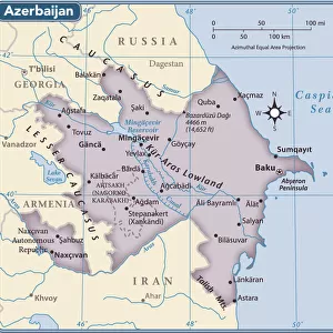
> Azerbaijan
> Maps
> Asia
> Azerbaijan
> Related Images
> Map Marketing
> UK Maps
MADE IN THE USA
Safe Shipping with 30 Day Money Back Guarantee
FREE PERSONALISATION*
We are proud to offer a range of customisation features including Personalised Captions, Color Filters and Picture Zoom Tools
SECURE PAYMENTS
We happily accept a wide range of payment options so you can pay for the things you need in the way that is most convenient for you
* Options may vary by product and licensing agreement. Zoomed Pictures can be adjusted in the Cart.