Home > Europe > United Kingdom > Northern Ireland > County Down > Newcastle
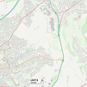
Newcastle NE15 0 Map

![]()
Wall Art and Photo Gifts from Map Marketing
Newcastle NE15 0 Map
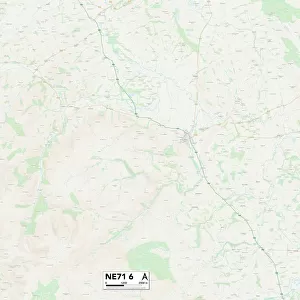
Postcode Sector Map of Newcastle NE15 0
Media ID 19974670
Birks Road Centurion Way Cherry Tree Gardens Cobblers Lane Crofts Lane Hexham Road Military Road Mill Lane Mill Way Newcastle Station Road Stonecroft Tynedale Close Wade Avenue Water Lane Campus Martius Horsley Houghton
FEATURES IN THESE COLLECTIONS
> Animals
> Mammals
> Muridae
> Heath Mouse
> Europe
> United Kingdom
> Northern Ireland
> County Down
> Newcastle
> Map Marketing
> Postcode Sector Maps
> NE - Newcastle upon Tyne
> Maps and Charts
> Related Images
> Popular Themes
> Hadrian's Wall
> Related Images
MADE IN THE USA
Safe Shipping with 30 Day Money Back Guarantee
FREE PERSONALISATION*
We are proud to offer a range of customisation features including Personalised Captions, Color Filters and Picture Zoom Tools
SECURE PAYMENTS
We happily accept a wide range of payment options so you can pay for the things you need in the way that is most convenient for you
* Options may vary by product and licensing agreement. Zoomed Pictures can be adjusted in the Cart.