Home > Europe > United Kingdom > England > London > Towns > Havering-atte-Bower
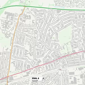
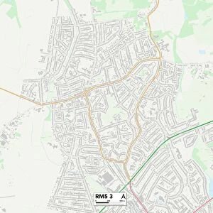
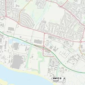
Havering RM4 1 Map

![]()
Wall Art and Photo Gifts from Map Marketing
Havering RM4 1 Map
Postcode Sector Map of Havering RM4 1
Media ID 19979135
Alderwood Close Church Lane Church Road Featherbed Lane Field Close Havering Hoe Lane Hook Lane London Road Long Meadow Manor Road Market Place Mill Lane New Road North End North Road Ongar Road Orchid Close Paternoster Row Pinewood Road Silver Street Stapleford Road Sunset Drive The Chestnuts The Paddocks The Poplars Valley Drive B175 Fir Trees Kensington Park Lambourne White Hall
FEATURES IN THESE COLLECTIONS
> Animals
> Mammals
> Muridae
> Heath Mouse
> Europe
> United Kingdom
> England
> London
> Boroughs
> Havering
> Europe
> United Kingdom
> England
> London
> Boroughs
> Kensington and Chelsea
> Europe
> United Kingdom
> England
> London
> Towns
> Bedford Park
> Europe
> United Kingdom
> England
> London
> Towns
> Church End
> Europe
> United Kingdom
> England
> London
> Towns
> Elm Park
> Europe
> United Kingdom
> England
> London
> Towns
> Havering-atte-Bower
> Europe
> United Kingdom
> England
> London
> Towns
> Heath Park
> Europe
> United Kingdom
> England
> London
> Towns
> Mill Hill
> Europe
> United Kingdom
> England
> London
> Towns
> Hook
> Map Marketing
> Postcode Sector Maps
> RM - Romford
MADE IN THE USA
Safe Shipping with 30 Day Money Back Guarantee
FREE PERSONALISATION*
We are proud to offer a range of customisation features including Personalised Captions, Color Filters and Picture Zoom Tools
SECURE PAYMENTS
We happily accept a wide range of payment options so you can pay for the things you need in the way that is most convenient for you
* Options may vary by product and licensing agreement. Zoomed Pictures can be adjusted in the Cart.