Home > Europe > United Kingdom > England > London > Art > Venues > St Pauls Church
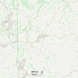
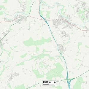
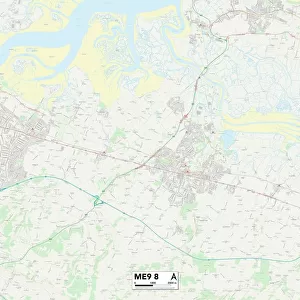
Swale ME13 9 Map

![]()
Wall Art and Photo Gifts from Map Marketing
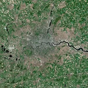
Swale ME13 9 Map
Postcode Sector Map of Swale ME13 9
Media ID 19975117
Berkeley Close Brickfield Lane Broom Street Bull Lane Bushey Close Canterbury Road Chestnut Court Church Hill Church Lane Courtenay Road Crouch Lane Drove Lane Dunkirk Dunkirk Road Featherbed Lane Fernleigh Close Gas Lane George Lane Grove Road Highview Close London Road Newhouse Lane North Lane Orchard Gate Red Road School Lane South Street St Pauls Crescent St Pauls Road St Peters Road Stoney Road Swale The Crescent The Ridgeway The Street The Warren Vicarage Lane Wheatsheaf Close Whitstable Road Woodlands Woodside Crouch Highstreet Winterbourne
FEATURES IN THESE COLLECTIONS
> Animals
> Mammals
> Muridae
> Peters Mouse
> Arts
> Artists
> D
> George Dawe
> Arts
> Artists
> P
> George Pickering
> Europe
> United Kingdom
> England
> London
> Art
> Venues
> St Pauls Church
> Europe
> United Kingdom
> England
> London
> Sights
> St Pauls Cathedral
> Europe
> United Kingdom
> England
> London
> Towns
> Charlton
> Europe
> United Kingdom
> England
> London
> Towns
> Church End
> Europe
> United Kingdom
> England
> London
> Towns
> Crouch End
> Europe
> United Kingdom
> England
> London
> Towns
> North End
> Europe
> United Kingdom
> England
> London
> Towns
> Wood Green
> Map Marketing
> Postcode Sector Maps
> ME - Rochester
MADE IN THE USA
Safe Shipping with 30 Day Money Back Guarantee
FREE PERSONALISATION*
We are proud to offer a range of customisation features including Personalised Captions, Color Filters and Picture Zoom Tools
SECURE PAYMENTS
We happily accept a wide range of payment options so you can pay for the things you need in the way that is most convenient for you
* Options may vary by product and licensing agreement. Zoomed Pictures can be adjusted in the Cart.