Home > Europe > United Kingdom > England > London > Boroughs > Enfield
Enfield EN4 8 Map

![]()
Wall Art and Photo Gifts from Map Marketing
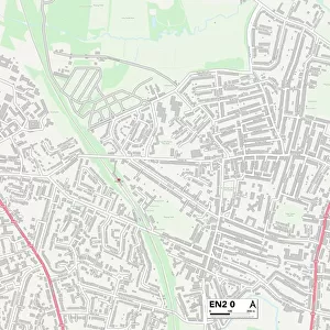
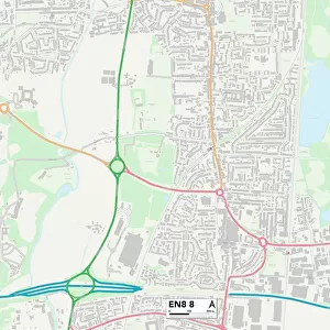
Enfield EN4 8 Map
Postcode Sector Map of Enfield EN4 8
Media ID 19970045
Albemarle Road Avondale Avenue Beeston Road Belmont Avenue Berkeley Crescent Brookhill Close Brookside Cambridge Close Capel Road Cedar Avenue Chestnut Grove Church Hill Road Clarence Close Connaught Avenue Cranbrook Road Derwent Avenue East Road Edward Road Enfield Eton Avenue Fitzwilliam Close Grange Avenue Haslemere Avenue Henry Road Hereford Avenue Jackson Road Kingston Road Lancaster Road Mansfield Avenue Middle Road Myrtle Close Parkside Gardens Ridgeway Avenue Rosslyn Avenue St Marys Road Station Approach Stevenson Close Stuart Road Sycamore Close Tewkesbury Close The Close Trevor Close Uplands Road Welbeck Road West Road West Walk Windsor Drive Woodfield Drive Wyndham Road East Walk
FEATURES IN THESE COLLECTIONS
> Europe
> United Kingdom
> England
> Herefordshire
> Maps
> Europe
> United Kingdom
> England
> London
> Boroughs
> Barnet
> Europe
> United Kingdom
> England
> London
> Boroughs
> Enfield
> Map Marketing
> Postcode Sector Maps
> EN - Enfield
> Maps and Charts
> Related Images
MADE IN THE USA
Safe Shipping with 30 Day Money Back Guarantee
FREE PERSONALISATION*
We are proud to offer a range of customisation features including Personalised Captions, Color Filters and Picture Zoom Tools
SECURE PAYMENTS
We happily accept a wide range of payment options so you can pay for the things you need in the way that is most convenient for you
* Options may vary by product and licensing agreement. Zoomed Pictures can be adjusted in the Cart.