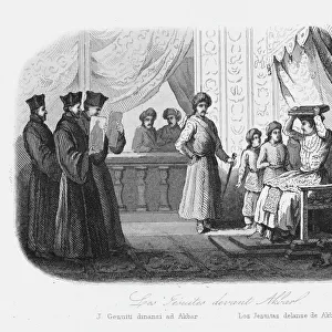
Home > Europe > United Kingdom > England > London > Sights > Mile End Park
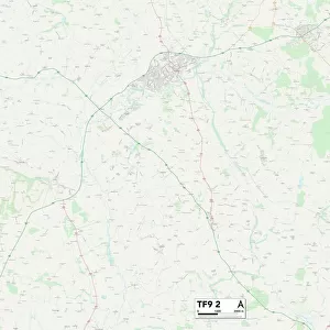
South Oxfordshire RG9 6 Map

![]()
Wall Art and Photo Gifts from Map Marketing
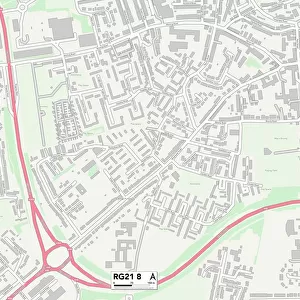
South Oxfordshire RG9 6 Map
Postcode Sector Map of South Oxfordshire RG9 6
Media ID 19981054
Chequers Lane Chestnut Close Church Hill Church Lane Drovers Lane Holloway Lane Hornbeam Close Ladies Walk Mill Close Moor End Northend Park Corner Park Lane Rectory Hill Rectory Lane Red Lane Rotten Row School Lane South Oxfordshire Southend The Glade Watery Lane White Lane Fawley Fingest Hambleden Pheasants Ridgewood Stonor Turville
FEATURES IN THESE COLLECTIONS
> Animals
> Birds
> Phasianidae
> Green Pheasant
> Animals
> Mammals
> Muridae
> Heath Mouse
> Europe
> United Kingdom
> England
> London
> Sights
> Mile End Park
> Europe
> United Kingdom
> England
> Oxfordshire
> Bix
> Europe
> United Kingdom
> England
> Oxfordshire
> Park Corner
> Europe
> United Kingdom
> England
> Oxfordshire
> Related Images
> Europe
> United Kingdom
> England
> Oxfordshire
> Stonor
> Map Marketing
> Postcode Sector Maps
> RG - Reading
> Maps and Charts
> Related Images
MADE IN THE USA
Safe Shipping with 30 Day Money Back Guarantee
FREE PERSONALISATION*
We are proud to offer a range of customisation features including Personalised Captions, Color Filters and Picture Zoom Tools
SECURE PAYMENTS
We happily accept a wide range of payment options so you can pay for the things you need in the way that is most convenient for you
* Options may vary by product and licensing agreement. Zoomed Pictures can be adjusted in the Cart.