Home > Europe > United Kingdom > Wales > Flintshire > Broughton
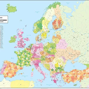
Wirral CH44 4 Map

![]()
Wall Art and Photo Gifts from Map Marketing
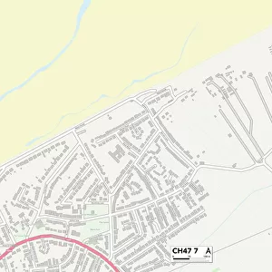
Wirral CH44 4 Map
Postcode Sector Map of Wirral CH44 4
Media ID 19968263
Alderley Road Beechcroft Road Broughton Road Burnside Avenue Burnside Road Ch44 Clifford Road Dock Road Duke Street Evelyn Road Gorsey Lane Hillcroft Road Kingsley Road Logan Road Millbrook Road Mostyn Street Norwood Road Rufford Road Sovereign Way The Grove Willow Close Wirral Poulton
FEATURES IN THESE COLLECTIONS
> Arts
> Portraits
> Pop art gallery
> Street art portraits
> Europe
> United Kingdom
> Wales
> Flintshire
> Broughton
> Map Marketing
> Postcode Sector Maps
> CH - Chester
> Map Marketing
> UK Maps
> Maps and Charts
> Related Images
MADE IN THE USA
Safe Shipping with 30 Day Money Back Guarantee
FREE PERSONALISATION*
We are proud to offer a range of customisation features including Personalised Captions, Color Filters and Picture Zoom Tools
SECURE PAYMENTS
We happily accept a wide range of payment options so you can pay for the things you need in the way that is most convenient for you
* Options may vary by product and licensing agreement. Zoomed Pictures can be adjusted in the Cart.