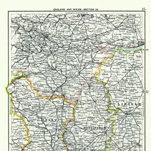
Home > Europe > United Kingdom > Scotland > Strathclyde > Oban
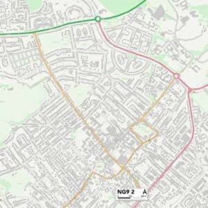
Broxtowe NG9 4 Map

![]()
Wall Art and Photo Gifts from Map Marketing
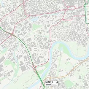
Broxtowe NG9 4 Map
Postcode Sector Map of Broxtowe NG9 4
Media ID 19976040
Ashley Close Barn Croft Beaufort Drive Blandford Road Bridge Avenue Broxtowe Cedar Road Central Avenue Clumber Avenue College Road Cresswell Road Cumberland Avenue Dale Lane Fairway Drive Felton Close Grove Avenue Harris Road Hawker Close Holly Lane Lark Close Lynton Road Marriott Close Mottram Road Norman Close North Drive Nursery Avenue Oban Road Orchard Crescent Pearson Avenue Richmond Drive Slade Road Solway Close Sunnyside Road The Copse Valley Road Wentworth Road Woodville Close
FEATURES IN THESE COLLECTIONS
> Animals
> Birds
> Passerines
> Larks
> Related Images
> Europe
> United Kingdom
> England
> Cumberland
> Europe
> United Kingdom
> Scotland
> Strathclyde
> Oban
> Map Marketing
> Postcode Sector Maps
> NG - Nottingham
> Maps and Charts
> Related Images
MADE IN THE USA
Safe Shipping with 30 Day Money Back Guarantee
FREE PERSONALISATION*
We are proud to offer a range of customisation features including Personalised Captions, Color Filters and Picture Zoom Tools
SECURE PAYMENTS
We happily accept a wide range of payment options so you can pay for the things you need in the way that is most convenient for you
* Options may vary by product and licensing agreement. Zoomed Pictures can be adjusted in the Cart.