Home > Arts > Artists > B > John Brown
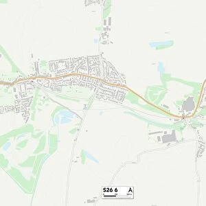
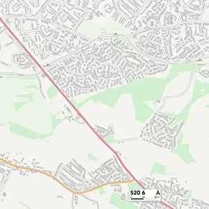
Rotherham S60 1 Map

![]()
Wall Art and Photo Gifts from Map Marketing
Rotherham S60 1 Map
Postcode Sector Map of Rotherham S60 1
Media ID 19978828
Albert Street Bridge Street Brown Street Centenary Way Central Road Chapel Walk Church Street College Road Corporation Street Don Street Field Way Fisher Close Forge Lane Forge Way Frederick Street Fullerton Road Garden Lane George Street Hall Street Hope Street James Street John Street Lincoln Street Main Street Market Place Market Street Marsh Street Mary Street Mill Close Milton Street Neville Street North Drive North Street Northfield Northfield Road Orchard Place Princes Street Providence Street Riverside Way Robert Street Rotherham Rotherham Road Sheffield Road St Johns Avenue Station Road Temple Close Temple Road Thames Street Victoria Street Vine Close Walter Street Water Lane Winifred Street Amen Corner Bridgegate Glasshouse Street The Point
FEATURES IN THESE COLLECTIONS
> Arts
> Artists
> B
> John Brown
> Arts
> Artists
> B
> John George Brown
> Arts
> Artists
> C
> Frederick Church
> Arts
> Artists
> D
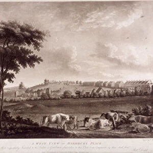
> Robert Dodd
> Arts
> Artists
> F
> John Field
> Arts
> Artists
> F
> Walter Field
> Arts
> Artists
> H
> James Hope
> Arts
> Artists
> H
> John Hillers
> Arts
> Artists
> H
> John Hills
> Arts
> Artists
> H
> Robert Hills
> Map Marketing
> Postcode Sector Maps
> S - Sheffield
MADE IN THE USA
Safe Shipping with 30 Day Money Back Guarantee
FREE PERSONALISATION*
We are proud to offer a range of customisation features including Personalised Captions, Color Filters and Picture Zoom Tools
SECURE PAYMENTS
We happily accept a wide range of payment options so you can pay for the things you need in the way that is most convenient for you
* Options may vary by product and licensing agreement. Zoomed Pictures can be adjusted in the Cart.