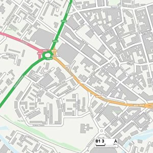
Home > Europe > United Kingdom > England > Birmingham > Area > Wylde Green
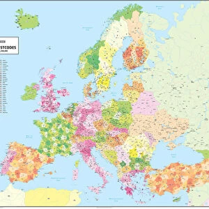
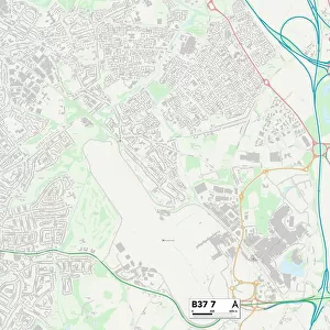
Sandwell B65 9 Map

![]()
Wall Art and Photo Gifts from Map Marketing
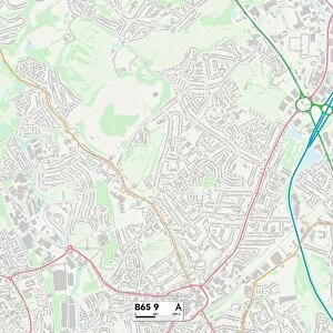
Sandwell B65 9 Map
Postcode Sector Map of Sandwell B65 9
Media ID 19965421
Balmoral Way Birmingham Road Britannia Road Buckingham Road Carlyle Road Causeway Charles Avenue Church Road Crown Close Elmhurst Avenue Enfield Road Greenwood Avenue Hanover Road Highbury Avenue Highbury Close Lawton Close Limes Avenue Newhall Road Norman Terrace Old School Drive Palace Close Park Avenue Portway Portway Road Queens Drive Reservoir Road Roman Way Royal Close Ruskin Avenue Sandford Avenue Sandringham Drive Sandwell Saxon Drive Spring Avenue St Giles Close St Lukes Close Stuart Road Summer Road Tudor Road Uplands Avenue Windsor Close Windsor Road Mincing Lane
FEATURES IN THESE COLLECTIONS
> Architecture
> Great Houses
> Buckingham Palace
> Arts
> Artists
> B
> Charles Bell
> Arts
> Artists
> G
> Charles Green
> Arts
> Artists
> R
> Roman Roman
> Arts
> Artists
> T
> Charles Turner
> Europe
> United Kingdom
> England
> Birmingham
> Area
> Hall Green
> Europe
> United Kingdom
> England
> Birmingham
> Area
> Rowley Regis
> Europe
> United Kingdom
> England
> Birmingham
> Area
> Tudor Hill
> Europe
> United Kingdom
> England
> Birmingham
> Area
> Wylde Green
> Europe
> United Kingdom
> England
> London
> Boroughs
> Enfield
> Map Marketing
> Postcode Sector Maps
> B - Birmingham
> Map Marketing
> UK Maps
MADE IN THE USA
Safe Shipping with 30 Day Money Back Guarantee
FREE PERSONALISATION*
We are proud to offer a range of customisation features including Personalised Captions, Color Filters and Picture Zoom Tools
SECURE PAYMENTS
We happily accept a wide range of payment options so you can pay for the things you need in the way that is most convenient for you
* Options may vary by product and licensing agreement. Zoomed Pictures can be adjusted in the Cart.