Home > Europe > United Kingdom > England > London > Towns > West Green
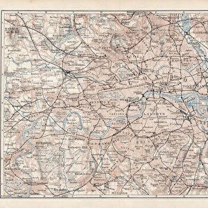
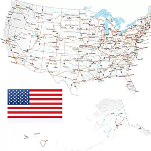
Postcode Sector Map sheet 8 London and M25

![]()
Wall Art and Photo Gifts from Map Marketing
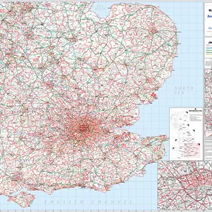
Postcode Sector Map sheet 8 London and M25
This Postcode Sector Map (sheet 8) displays all of the first part of the postcode and the first number of the second part, or Inward Code, (eg EX20 3) for London and the M25. The map covers from Potters Bar in the north to Oxted in the south and from Thurrock in the east to Slough in the west. Detailed street level insets are included for central London in the key panel. The Area, District and Sector postcode boundaries and labels are displayed in red with County and Unitary Authority boundaries and names presented in green. The detailed map base is printed in greyscale to enable the postcodes to stand out and shows a comprehensive road network and a high level of urban areas
Media ID 19950409
© Map Marketing Ltd 2019, Map derived from Collins Bartholomew Digital Data Collins Bartholomew Ltd 2019
London Street Postcodes Sectors Boroughs
FEATURES IN THESE COLLECTIONS
> Arts
> Contemporary art
> Digital artwork
> Street art
> Arts
> Photorealistic artworks
> Detailed art pieces
> Masterful detailing in art
> Arts
> Street art graffiti
> Digital art
> Urban art
> Europe
> United Kingdom
> England
> London
> Boroughs
> Related Images
> Europe
> United Kingdom
> England
> London
> Towns
> West Green
> Maps and Charts
> Related Images
MADE IN THE USA
Safe Shipping with 30 Day Money Back Guarantee
FREE PERSONALISATION*
We are proud to offer a range of customisation features including Personalised Captions, Color Filters and Picture Zoom Tools
SECURE PAYMENTS
We happily accept a wide range of payment options so you can pay for the things you need in the way that is most convenient for you
* Options may vary by product and licensing agreement. Zoomed Pictures can be adjusted in the Cart.