Home > Europe > United Kingdom > Wales > Pembrokeshire > Pembroke
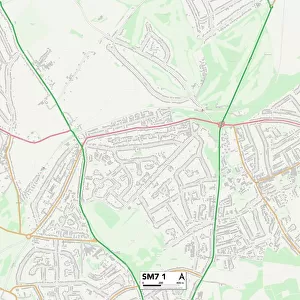
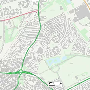
Reigate and Banstead SM7 2 Map

![]()
Wall Art and Photo Gifts from Map Marketing
Reigate and Banstead SM7 2 Map
Postcode Sector Map of Reigate and Banstead SM7 2
Media ID 19981712
Ashley Drive Avenue Road Castleton Close Cheviot Close Clifton Place Court Road Elizabeth Drive Ferndale Road Garden Close Glenfield Road High Street Holly Lane Kenilworth Close Kingsley Avenue Lambert Road Monks Road Neville Close Oakley Gardens Park Road Pembroke Close Pound Road Reigate And Banstead Stirling Close The Beeches The Fieldings The Horseshoe The Laurels The Orchard The Oval Thornfield Road Banstead
FEATURES IN THESE COLLECTIONS
> Europe
> United Kingdom
> Scotland
> Stirlingshire
> Stirling
> Europe
> United Kingdom
> Wales
> Pembrokeshire
> Pembroke
> Map Marketing
> Postcode Sector Maps
> SM - Sutton
> Maps and Charts
> Related Images
MADE IN THE USA
Safe Shipping with 30 Day Money Back Guarantee
FREE PERSONALISATION*
We are proud to offer a range of customisation features including Personalised Captions, Color Filters and Picture Zoom Tools
SECURE PAYMENTS
We happily accept a wide range of payment options so you can pay for the things you need in the way that is most convenient for you
* Options may vary by product and licensing agreement. Zoomed Pictures can be adjusted in the Cart.