Home > Europe > United Kingdom > England > London > Towns > Bromley Common
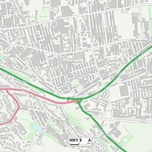
Bromley TN16 1 Map

![]()
Wall Art and Photo Gifts from Map Marketing
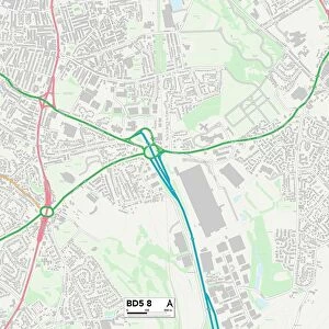
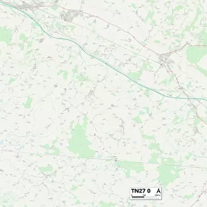
Bromley TN16 1 Map
Postcode Sector Map of Bromley TN16 1
Media ID 19980238
Ash Road Bromley Church Road Coles Lane Croft Road Croydon Road Elm Road Farley Lane French Street Grange Close Granville Road Hartley Road High Street Holcombe Close Lodge Lane London Road Main Road Market Square Market Way Mill Lane Mill Street Moorhouse Road New Street Oak Road Pipers Lane Railway Terrace Rectory Lane Sandy Lane South Bank St Marys Court Station Road Swan Place The Green The Paddock Vicarage Hill Walnut Tree Close Watermill Close Wells Close West End Westerham Road Brasted Westerham
FEATURES IN THESE COLLECTIONS
> Animals
> Birds
> Accipitriformes
> Accipitridae
> Black Eagle
> Animals
> Birds
> Waterfowl
> Swans
> Black Swan
> Europe
> United Kingdom
> England
> London
> Boroughs
> Bromley
> Europe
> United Kingdom
> England
> London
> Boroughs
> Croydon
> Europe
> United Kingdom
> England
> London
> Sights
> High Court
> Europe
> United Kingdom
> England
> London
> Towns
> Bromley Common
> Europe
> United Kingdom
> England
> London
> Towns
> Bromley
> Europe
> United Kingdom
> England
> London
> Towns
> Church End
> Map Marketing
> Postcode Sector Maps
> TN - Tunbridge Wells
MADE IN THE USA
Safe Shipping with 30 Day Money Back Guarantee
FREE PERSONALISATION*
We are proud to offer a range of customisation features including Personalised Captions, Color Filters and Picture Zoom Tools
SECURE PAYMENTS
We happily accept a wide range of payment options so you can pay for the things you need in the way that is most convenient for you
* Options may vary by product and licensing agreement. Zoomed Pictures can be adjusted in the Cart.