Home > Europe > United Kingdom > England > London > Boroughs > Bromley
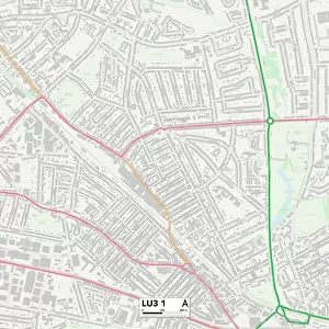
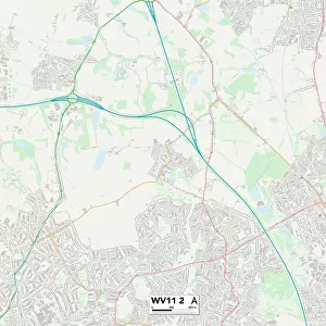
Wolverhampton WV2 3 Map

![]()
Wall Art and Photo Gifts from Map Marketing
Wolverhampton WV2 3 Map
Postcode Sector Map of Wolverhampton WV2 3
Media ID 19983312
Arthur Street Brodie Close Bromley Street Chapel Street Cooke Street Curzon Street Dudley Road Duncan Street Fowler Street Grove Street Hawthorne Road Johnson Street Knox Road Mason Street Napier Road Phoenix Street Poplar Street Ranelagh Road Rosemary Avenue Shaw Road Strode Road Talbot Road The Haven Thompson Avenue Wolverhampton Phoenix Park
FEATURES IN THESE COLLECTIONS
> Abstract Art
> Rainbows
> Arts
> Portraits
> Pop art gallery
> Street art portraits
> Europe
> United Kingdom
> England
> London
> Boroughs
> Bromley
> Map Marketing
> Postcode Sector Maps
> WV - Wolverhampton
> Map Marketing
> UK Maps
> Maps and Charts
> Related Images
MADE IN THE USA
Safe Shipping with 30 Day Money Back Guarantee
FREE PERSONALISATION*
We are proud to offer a range of customisation features including Personalised Captions, Color Filters and Picture Zoom Tools
SECURE PAYMENTS
We happily accept a wide range of payment options so you can pay for the things you need in the way that is most convenient for you
* Options may vary by product and licensing agreement. Zoomed Pictures can be adjusted in the Cart.