Home > Europe > United Kingdom > Scotland > Highlands > Wick
Bournemouth BH6 4 Map

![]()
Wall Art and Photo Gifts from Map Marketing
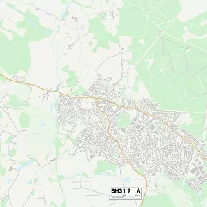
Bournemouth BH6 4 Map
Postcode Sector Map of Bournemouth BH6 4
Media ID 19966086
Admiralty Road Ariel Close Baring Road Belfield Road Bournemouth Braemar Avenue Braemar Close Broadlands Avenue Broadway Church Road Dalmeny Road Ferry Road Glendale Road Harbour Road Harland Road Kingsley Avenue Kingsley Close Magnolia Close Promenade Riversdale Road Sea Road Solent Road Southlands Avenue Springfield Avenue St Catherines Road Stevenson Road Thornbury Road Viking Close Viking Way Wick Wick Lane Wollaston Road Hengistbury Head
FEATURES IN THESE COLLECTIONS
> Animals
> Mammals
> Vespertilionidae
> Ariel
> Europe
> United Kingdom
> Scotland
> Highlands
> Wick
> Map Marketing
> Postcode Sector Maps
> BH - Bournemouth
> Maps and Charts
> Related Images
MADE IN THE USA
Safe Shipping with 30 Day Money Back Guarantee
FREE PERSONALISATION*
We are proud to offer a range of customisation features including Personalised Captions, Color Filters and Picture Zoom Tools
SECURE PAYMENTS
We happily accept a wide range of payment options so you can pay for the things you need in the way that is most convenient for you
* Options may vary by product and licensing agreement. Zoomed Pictures can be adjusted in the Cart.