Home > Europe > United Kingdom > England > Oxfordshire > Aston
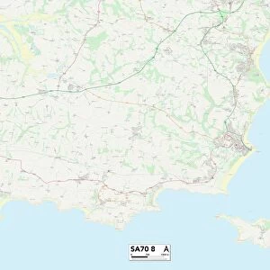
South Oxfordshire RG9 3 Map

![]()
Wall Art and Photo Gifts from Map Marketing
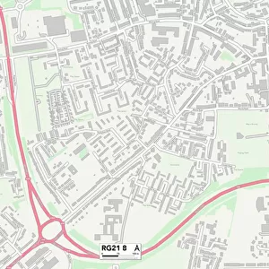
South Oxfordshire RG9 3 Map
Postcode Sector Map of South Oxfordshire RG9 3
Media ID 19981044
Aston Aston Lane Badgers Walk Dairy Lane Ferry Lane Greenlands Marlow Road Mill End Mill Lane Mill Road New Road Northfield Avenue Northfield Road Nursery Close Oaks Road Quarry Lane South Oxfordshire Station Road The Chestnuts The Crescent Westfield Crescent White Hill Henley On Thames Shiplake
FEATURES IN THESE COLLECTIONS
> Europe
> United Kingdom
> England
> Oxfordshire
> Aston
> Europe
> United Kingdom
> England
> Oxfordshire
> Henley-on-Thames
> Europe
> United Kingdom
> England
> Oxfordshire
> Henley on Thames
> Europe
> United Kingdom
> England
> Oxfordshire
> Related Images
> Europe
> United Kingdom
> England
> Oxfordshire
> Shiplake
> Map Marketing
> Postcode Sector Maps
> RG - Reading
> Maps and Charts
> Related Images
> North America
> Greenland
> Maps
> North America
> Greenland
> Related Images
MADE IN THE USA
Safe Shipping with 30 Day Money Back Guarantee
FREE PERSONALISATION*
We are proud to offer a range of customisation features including Personalised Captions, Color Filters and Picture Zoom Tools
SECURE PAYMENTS
We happily accept a wide range of payment options so you can pay for the things you need in the way that is most convenient for you
* Options may vary by product and licensing agreement. Zoomed Pictures can be adjusted in the Cart.