Home > Animals > Fishes > C > Char
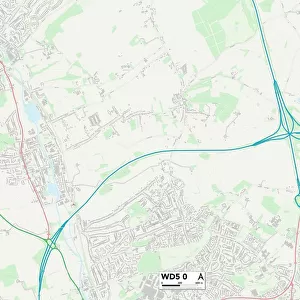
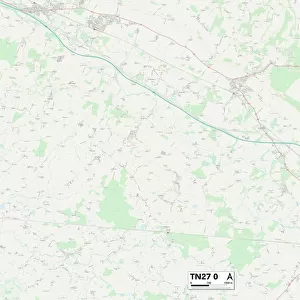
Ashford TN27 0 Map

![]()
Wall Art and Photo Gifts from Map Marketing
Ashford TN27 0 Map
Postcode Sector Map of Ashford TN27 0
Media ID 19982568
Ashford Ashford Road Blackberry Lane Burleigh Road Canterbury Road Centenary Close Cherry Tree Road Church Hill Coach Road Downs Close Downs Way Egerton Road Faversham Road Hook Lane Hurst Lane Maidstone Road Market Place Monks Walk Newlands Road Pilgrims Way Poppyfields School Road Station Road Swan Lane The Glebe The Grove The Hill The Moat The Street The Wynd Vicarage Lane Warren Street Westfields Charing
FEATURES IN THESE COLLECTIONS
> Animals
> Mammals
> Muridae
> Heath Mouse
> Map Marketing
> Postcode Sector Maps
> TN - Tunbridge Wells
> Maps and Charts
> Related Images
MADE IN THE USA
Safe Shipping with 30 Day Money Back Guarantee
FREE PERSONALISATION*
We are proud to offer a range of customisation features including Personalised Captions, Color Filters and Picture Zoom Tools
SECURE PAYMENTS
We happily accept a wide range of payment options so you can pay for the things you need in the way that is most convenient for you
* Options may vary by product and licensing agreement. Zoomed Pictures can be adjusted in the Cart.