Home > Europe > United Kingdom > England > London > Boroughs > Bromley
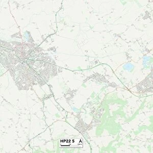
Bromley TN14 6 Map

![]()
Wall Art and Photo Gifts from Map Marketing
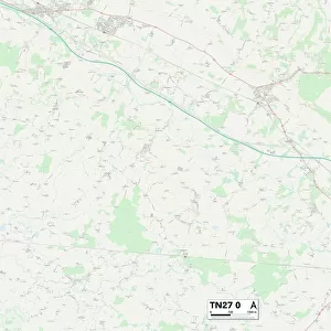
Bromley TN14 6 Map
Postcode Sector Map of Bromley TN14 6
Media ID 19980226
Back Lane Bromley Chapmans Close Church Road Elmfield Close Glebe Road Hurst Lane Main Road Manor Road Mount Pleasant Road New Road Nightingale Lane Norman Street Overdale Penn Lane The Wickets Weald Close White House Lane White House Road Windmill Road Woodside Road Ide Hill
FEATURES IN THESE COLLECTIONS
> Animals
> Birds
> Passerines
> Chats And Flycatchers
> Nightingale
> Europe
> United Kingdom
> England
> London
> Boroughs
> Bromley
> Map Marketing
> Postcode Sector Maps
> TN - Tunbridge Wells
> Maps and Charts
> Related Images
MADE IN THE USA
Safe Shipping with 30 Day Money Back Guarantee
FREE PERSONALISATION*
We are proud to offer a range of customisation features including Personalised Captions, Color Filters and Picture Zoom Tools
SECURE PAYMENTS
We happily accept a wide range of payment options so you can pay for the things you need in the way that is most convenient for you
* Options may vary by product and licensing agreement. Zoomed Pictures can be adjusted in the Cart.