Home > Europe > United Kingdom > England > London > Towns > Elmstead
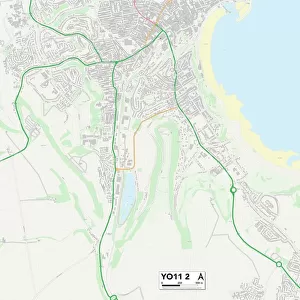
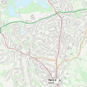
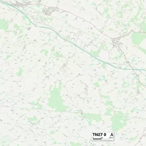
Sevenoaks TN13 2 Map

![]()
Wall Art and Photo Gifts from Map Marketing
Sevenoaks TN13 2 Map
Postcode Sector Map of Sevenoaks TN13 2
Media ID 19980218
Anthony Close Bankside Barnfield Road Beacon Rise Braeside Avenue Braeside Close Bullfinch Close Centenary Close Chesterfield Drive Chichester Drive Cranmer Road Croft Way Donnington Road Downsview Road Grange Road Greenwood Way High Street Hillfield Road Homefield Road Kingswood Road Larkfield Road London Road Longford Longmeadow Lyndhurst Drive Marlborough Crescent Mere Road Mill Road Milton Road Moat Close Montreal Road Oak Lane Orchard Road Park Place Redlands Road Sevenoaks St Marys Drive Station Road The Close The Crescent The Orchard The Sidings The Terrace Vicarage Lane Westerham Road Wood Drive Woodfields Woodland Road Yew Tree Close Yew Tree Road Chipstead Riverhead Sandilands
FEATURES IN THESE COLLECTIONS
> Europe
> United Kingdom
> England
> London
> Sights
> Green Park
> Europe
> United Kingdom
> England
> London
> Sights
> High Court
> Europe
> United Kingdom
> England
> London
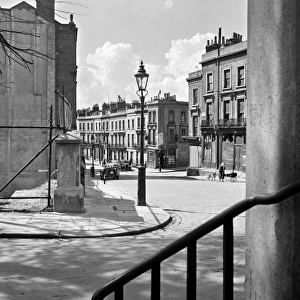
> Towns
> Elmstead
> Europe
> United Kingdom
> England
> London
> Towns
> Grange Park
> Europe
> United Kingdom
> England
> London
> Towns
> Mill Hill
> Europe
> United Kingdom
> England
> London
> Towns
> Wood Green
> Map Marketing
> Postcode Sector Maps
> TN - Tunbridge Wells
> Maps and Charts
> Related Images
> North America
> Saint Martin
> Maps
MADE IN THE USA
Safe Shipping with 30 Day Money Back Guarantee
FREE PERSONALISATION*
We are proud to offer a range of customisation features including Personalised Captions, Color Filters and Picture Zoom Tools
SECURE PAYMENTS
We happily accept a wide range of payment options so you can pay for the things you need in the way that is most convenient for you
* Options may vary by product and licensing agreement. Zoomed Pictures can be adjusted in the Cart.