Home > Europe > United Kingdom > England > London > Sights > Holland Park
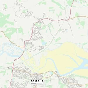
Tendring CO15 6 Map

![]()
Wall Art and Photo Gifts from Map Marketing
Tendring CO15 6 Map
Postcode Sector Map of Tendring CO15 6
Media ID 19968768
Albert Gardens Avondale Road Beaconsfield Road Carlton Road Carnarvon Road Chapman Road Church Crescent Church Road College Road Connaught Close Granville Road Greenacres Harold Road High Street Holland Park Holland Road Lyon Close Northbourne Road Recreation Road Russell Road St Albans Road St Pauls Road Station Road Tendring Vermont Close Victoria Road Walton Road Wyndham Crescent Clacton On Sea
FEATURES IN THESE COLLECTIONS
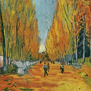
> Arts
> Portraits
> Pop art gallery
> Street art portraits
> Europe
> United Kingdom
> England
> London
> Sights
> Holland Park
> Europe
> United Kingdom
> England
> London
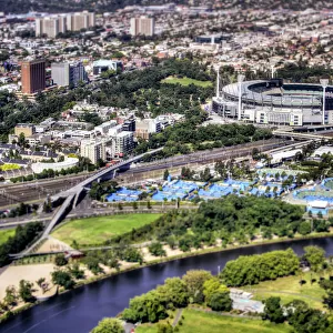
> Sights
> Victoria Park
> Map Marketing
> Postcode Sector Maps
> CO - Colchester
> Maps and Charts
> Related Images
> North America
> United States of America
> New York
> New York
> Brooklyn
> Marine Park
MADE IN THE USA
Safe Shipping with 30 Day Money Back Guarantee
FREE PERSONALISATION*
We are proud to offer a range of customisation features including Personalised Captions, Color Filters and Picture Zoom Tools
SECURE PAYMENTS
We happily accept a wide range of payment options so you can pay for the things you need in the way that is most convenient for you
* Options may vary by product and licensing agreement. Zoomed Pictures can be adjusted in the Cart.