Home > Europe > United Kingdom > England > London > Boroughs > Newham
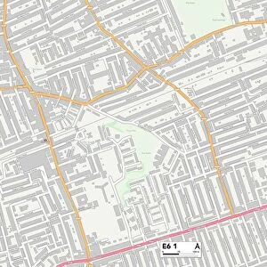
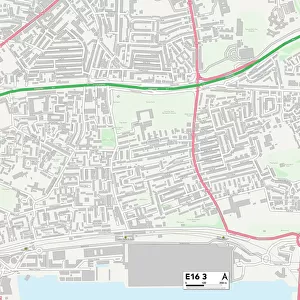
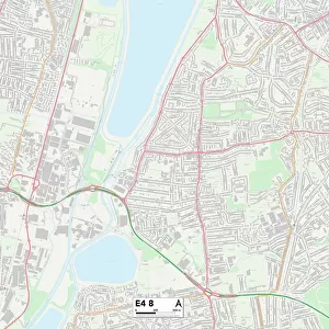
Newham E16 4 Map

![]()
Wall Art and Photo Gifts from Map Marketing
Newham E16 4 Map
Postcode Sector Map of Newham E16 4
Media ID 19970225
Addington Road Alexandra Street Avondale Road Beaconsfield Road Birch Close Blake Road Blanche Street Carson Road Chester Road Clarence Road Clifford Road Clifton Road Daisy Road Douglas Road Durham Road Edward Court Edward Street Fennel Close Fisher Street Florence Street Fox Road Gerald Road Grayling Close Hilda Road Kildare Road Kimberley Road Ladysmith Road Ling Road Liverpool Road Mafeking Road Malmesbury Road Manor Road Mary Street Maud Street Mona Street Morgan Street Newham North Crescent Oak Crescent Ordnance Road Percy Road Pretoria Road Ravenscroft Road South Crescent Star Lane Stephenson Street Sycamore Close Verbena Close Violet Close Wharf Street Cliff Walk Hermit Road
FEATURES IN THESE COLLECTIONS
> Animals
> Fishes
> G
> Grayling
> Animals
> Mammals
> Muridae
> Ling
> Europe
> United Kingdom
> England
> Durham
> Durham
> Europe
> United Kingdom
> England
> London
> Boroughs
> Newham
> Europe
> United Kingdom
> Scotland
> Aberdeenshire
> Maud
> Map Marketing
> Postcode Sector Maps
> E - London E
> Maps and Charts
> Related Images
> Maps and Charts
> Star Charts
MADE IN THE USA
Safe Shipping with 30 Day Money Back Guarantee
FREE PERSONALISATION*
We are proud to offer a range of customisation features including Personalised Captions, Color Filters and Picture Zoom Tools
SECURE PAYMENTS
We happily accept a wide range of payment options so you can pay for the things you need in the way that is most convenient for you
* Options may vary by product and licensing agreement. Zoomed Pictures can be adjusted in the Cart.