Home > Europe > United Kingdom > England > London > Boroughs > Camden
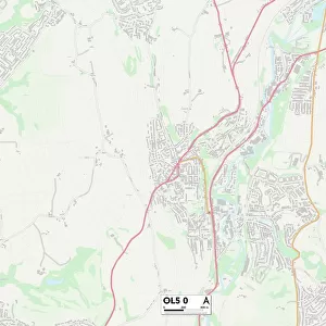
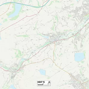
Tameside OL5 9 Map

![]()
Wall Art and Photo Gifts from Map Marketing
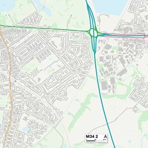
Tameside OL5 9 Map
Postcode Sector Map of Tameside OL5 9
Media ID 19977138
A635 Audley Street Boundary Close Brunswick Street Bury Street Camden Street Cemetery Road Church Lane Clarendon Street Cote Lane Crown Hill Dale Avenue Denbigh Street Derby Street Duke Street Gorse Avenue Heron Lane Hollins Lane Howards Lane Huddersfield Road King Street Manchester Road Mansfield Road Meadow Close Moorlands Drive Moorside Road Pennine View Princess Close Queensway Regent Drive Richmond Close Richmond Crescent St Anthonys Drive Stanhope Street Station Road Tame Street Tameside The Beeches The Larches The Laurels The Limes The Moorings The Poplars The Rowans The Sycamores The Uplands The Willows Tudor Close Vale View Waggon Road Woodend Blackrock Bottoms Roaches
FEATURES IN THESE COLLECTIONS
> Animals
> Birds
> Herons
> Related Images
> Animals
> Fishes
> R
> Roach
> Arts
> Portraits
> Pop art gallery
> Street art portraits
> Europe
> United Kingdom
> England
> Cheshire
> Beeston
> Europe
> United Kingdom
> England
> Cheshire
> Related Images
> Europe
> United Kingdom
> England
> London
> Boroughs
> Camden
> Europe
> United Kingdom
> England
> Manchester
> Manchester
> Europe
> United Kingdom
> England
> Manchester
> Micklehurst
> Europe
> United Kingdom
> England
> Manchester
> Moorside
> Europe
> United Kingdom
> Scotland
> Dumfries and Galloway
> Newbridge Drive
> Map Marketing
> Postcode Sector Maps
> OL - Oldham
> Map Marketing
> UK Maps
MADE IN THE USA
Safe Shipping with 30 Day Money Back Guarantee
FREE PERSONALISATION*
We are proud to offer a range of customisation features including Personalised Captions, Color Filters and Picture Zoom Tools
SECURE PAYMENTS
We happily accept a wide range of payment options so you can pay for the things you need in the way that is most convenient for you
* Options may vary by product and licensing agreement. Zoomed Pictures can be adjusted in the Cart.