Home > Europe > United Kingdom > England > London > Sights > Victoria Park
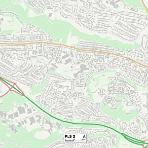
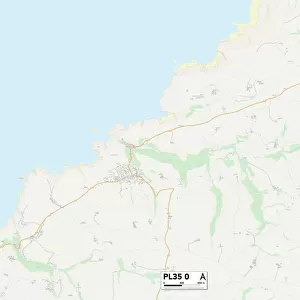
Plymouth PL5 1 Map

![]()
Wall Art and Photo Gifts from Map Marketing
Plymouth PL5 1 Map
Postcode Sector Map of Plymouth PL5 1
Media ID 19977468
Admiralty Road Beaufort Close Bridge View Carlton Terrace Chard Road Churchway Colebrook Road Coronation Place Creek Road Dawson Close Edith Street Evelyn Street Ferrers Road Florence Street Harbour View Road Ivanhoe Road Jackson Close Kelly Close Kiln Close Mackenzie Place Moor Lane Normandy Way Northumberland Street Old Farm Road Old School Road Percy Street Plymouth Riverside Roberts Road Rodney Street Scott Avenue Shelley Way Stanhope Road Stirling Road Tenby Road Trafalgar Close Trelawney Avenue Vicarage Gardens Wakefield Avenue Walters Road Waverley Road Westcroft Road Wilkinson Road Wolseley Road Woodstock Gardens York Road Talbot Gardens
FEATURES IN THESE COLLECTIONS
> Animals
> Mammals
> Muridae
> Peters Mouse
> Arts
> Artists
> H
> Robert Hills
> Arts
> Artists
> W
> Robert Wilkinson
> Europe
> United Kingdom
> England
> London
> Sights
> Victoria Park
> Europe
> United Kingdom
> England
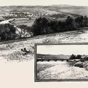
> Northumberland
> Haydon Bridge
> Europe
> United Kingdom
> England
> Northumberland
> Related Images
> Europe
> United Kingdom
> Scotland
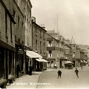
> Perth and Kinross
> Blairgowrie and Rattray
> Europe
> United Kingdom
> Scotland
> Stirlingshire
> Stirling
> Europe
> United Kingdom
> Wales
> Pembrokeshire
> Tenby
> Map Marketing
> Postcode Sector Maps
> PL - Plymouth
> Maps and Charts
> Related Images
MADE IN THE USA
Safe Shipping with 30 Day Money Back Guarantee
FREE PERSONALISATION*
We are proud to offer a range of customisation features including Personalised Captions, Color Filters and Picture Zoom Tools
SECURE PAYMENTS
We happily accept a wide range of payment options so you can pay for the things you need in the way that is most convenient for you
* Options may vary by product and licensing agreement. Zoomed Pictures can be adjusted in the Cart.